“…[samples were] reduced to graphite before AMS 14C analysis at the SUERC AMS Facility.”

To determine the rate of ice sheet retreat it is necessary to determine WHERE the ice sheet margin was WHEN. The WHERE is determined by studying landforms characteristic of glacier margins, such as moraines, erratic boulders, and sediment deposited both onshore and offshore by ice and glacial meltwater near the margins of the ice sheet. The WHEN is determined using different dating techniques depending on the material sampled. For BRITICE-CHRONO we are applying three different dating techniques, (1) optically stimulated luminescence dating (OSL) for sands, (2) radiocarbon dating (14C) for organic material like shell fragments picked out of sediment cores collected from the sea floor during the research cruises, and (3) surface exposure dating of rock using the terrestrial cosmogenic isotope beryllium-10 (10Be) in the mineral quartz.

Radiocarbon dating and surface exposure dating rely on being able to measure the abundance of extremely rare radioisotopes in the sample material using a technique called accelerator mass spectrometry (AMS) performed at the Scottish Universities Environmental Research Centre (SUERC) AMS Laboratory. What is extremely rare? Well, the natural abundance of 14C in modern carbon is 1 part per trillion (10-12) which gets smaller with the age of the material being dated because 14C decays after the death of the organism. The ratio between the radioisotope 10Be and stable beryllium is roughly 10-13 to 10-14 for surface exposure dating of BRITICE-CHRONO samples. To put this in perspective, if you counted at one number per second it would take you about 3.25 million years to count to 1014. In other words, radiocarbon and surface exposure dating is only possible because we are able to count individual radioisotopes among trillions of almost identical stable isotopes.

In scientific papers these  measurements are often summarised in a few words, such as “…[samples were] reduced to graphite before AMS 14C analysis at the SUERC AMS Facility” or “10Be/9Be ratios were derived from measurements at the SUERC AMS Laboratory”. Neither sentence does justice to the complexity of the method and the efforts of a dedicated team of scientists and technicians. Here I will try to provide some insight into how the concentrations of the extremely low quantities of 14C are determined using accelerator mass spectrometry (AMS). For 10Be the process is similar but explaining the differences would add unnecessary complexity in what follows.

Accelerator mass spectrometry (AMS) is an ultra-sensitive technique for isotopic analysis in which atoms extracted from a sample are ionized (the process by which an atom or a molecule acquires a negative or positive charge by gaining or losing electrons to form ions); accelerated to high energies; separated according to their momentum, charge, and energy; and then individually counted after identification as having the correct atomic number and mass. The principle difference between AMS and conventional mass spectrometry (MS) lies in the energies to which the ions are accelerated. In MS the energies are thousands of electron volts (1 keV = 1.6 x 10⁻¹⁶ J), whereas in AMS they are millions of electron volts (MeV). The practical consequences of having higher energies is that ambiguities in identification of atomic and molecular ions with the same mass are removed.

This is how we make the measurements at SUERC

Fig 1. Cathodes in sample wheel after measurement. The hole in the cathodes contains the sample and is 1mm wide.

Samples come to the AMS Laboratory in the form of pressed cathodes containing a few milligrams of graphite (for radiocarbon) and BeO mixed with Niobium for 10Be surface exposure dating. It takes a lot of time and effort to get from a sample collected in the field to the cathode stage, but that is another story.

The cathodes are loaded into a 134-position sample wheel together with standard materials that have known isotope ratios.

Fig 2. Sample wheel loaded in ion source.

Fig 2. Sample wheel loaded in ion source.

The wheel is loaded into the ion source, the ion source is closed and pumped down to the same very high vacuum as the remainder of the beam line (steel tube) through which the ions produced in the ion source are going to travel (the correct term is drift, but it does not really convey the speed at which the ions move). We need a very high vacuum (comparable to conditions found in outer space) because we do not want our ions to collide with neutral atoms or molecules drifting anywhere along the 32 metres of beam line.

Section through ionizer

Fig 3. Section through ionizer

We are now ready to perform some ion sorcery. We heat up a caesium reservoir to generate a Cs vapour in the space between the cathode holding our sample and a heated ionizing surface. Some of the vapour condenses onto the cooled cathode, some is ionised by the ionizer creating Cs+ ions that are accelerated and focused towards the sample because the sample cathode is at -5kV compared to the ionizer (Fig 4). The impact of the Cs+ ions on the sample surface causes sputtering of particles from the sample surface.
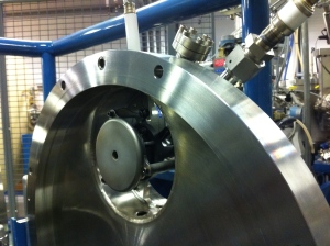
Fig 4. Cs+ focus lens at front of ioniser (Fig. 3). The sample cathode being ionised is located 1 mm in front of the hole in the lens

Fig 4. Cs+ focus lens at front of ioniser (Fig. 3). The sample cathode being ionised is located 1 mm in front of the hole in the lens

Some materials will preferentially sputter negative ions. Other materials will preferentially sputter neutral or positive particles, which pick up electrons as they pass through the condensed caesium layer, producing negative ions. All of this happens within 1 mm of the sample surface. The negative ions are removed from the sample surface and focused into the beam line by an extraction electrode (extractor) set at 15 kV. The extracted ion beam (shown in grey in Fig. 3) is spreading, just like the spreading of light from a torch (which is just another type of particle beam). This is known as beam emittance and it must be kept small to ensure high transmission to the detector. But I am getting way ahead of myself safe to say that we cannot get the emittance of the beam back to the original 1mm diameter at the sample surface and much of the experimental apparatus of the AMS is designed to focus the beam to specific places along the beam line.

ion source

Fig 5. Closed ion source. The metal rings around the beam line are part of the 45 kV injector. The apparatus to the left of the rings are for pumping the beam line and and focussing the beam.

So now we have extracted a negative ion beam from our sample material, and the ions are starting to move along the beam line. We accelerate the particles to 66 keV by exposing them to an additional 45kV in the injector (Fig. 5 and Fig 6). The particles pass through a spherical electrostatic analyser (ESA, Fig. 6), where particles with the incorrect energy over charge (E/q) are removed from the beam, before being injected into the accelerator via the injection magnet.

Fig 6. Schematic of SUERC 5MV tandem spectrometer.

Fig 6. Schematic of SUERC 5MV tandem spectrometer.

The injection magnet separates particles based on momentum (= mass x velocity). For radiocarbon we set the magnetic field to allow particles with mass 14 through the magnet and into the accelerator, but we also need to put carbon-12 and carbon-13 into the accelerator to get the ratio 14C/12C and 14C/13C. Since both 12C and 13C have lower mass than 14C we use a magnet bouncing system (MBS; Fig. 6) to give the ion beam more energy so that 12C and 13C temporarily behave like 14C. Because 12C and 13C are much more abundant than 14C we inject the former two for only a few microseconds per second. While 14C enters the accelerator we measure the 13C current in a low energy Faraday cup and the same is the case for 12C when 13C is injected (Fig. 6. Inset A). 14C cannot be measured in a Faraday cup because there are far too few atoms to generate a current.

Unfortunately sample materials are not pure and therefore ion sources do not only produce the ions we want. However the next stage in the process takes care of many of the molecular isobars (= same atomic mass number) such as the hydrocarbons 12CH2 and 13CH, which have the same atomic mass number as 14C and are therefore also injected into the accelerator.

So far the system described is similar to conventional mass spectrometry. The next stage in the ion transport is what sets AMS apart. Up to now the ions have been energised by the ion source and injector to 66keV (the low energy end of the spectrometer), which means they are travelling at roughly 1000 km/s. Next they are accelerated to a speed of roughly 7500 km/s by exposing the negatively charged ions to a 4.5 MV positive charge at the terminal in the centre of the 8 m long accelerator tank (Fig. 6 & 7).

Fig 7. Accelerator pressure vessel known as the tank. It is filled with an insulating gas.

Fig 7. Accelerator pressure vessel known as the tank. It is filled with an insulating gas.

When the negatively charged ions reach the terminal they pass through a gas stripper (Fig. 6). The collisions between the ions and the gas removes electrons from the ions thereby changing them from being negatively charged to being positively charged. The terminal voltage is set to remove at least three electrons because by this process molecular isobars of 14C (such as 12CH2 or 13CH) are destroyed due to the high instability of their positively charged forms, and atomic C+ ions such as 12C+, 13C+, and 14C+ can be separated due to their different mass to charge ratios. Once the now positive atomic ions emerge from the stripper they find themselves next to a very high positive charge (4.5 MV in the case of radiocarbon) and they accelerate away from this, hence the term tandem accelerator (two acceleration steps). The particles emerge from the tank at a velocity of greater than 17000 km/s (that’s equivalent to traveling around the Earth at the equator in just over 2 seconds), the high-energy part of the AMS.

The particles now enter another mass spectrometer, the analysing magnet (Fig. 6), where the 12C+, 13C+, and 14C+ are separated according to momentum. 12C+ and 13C+ currents are bent more than 14C+ and are collected and measured in Faraday cups, while 14C+ is allowed to continue on towards the gas ionisation detector. Even after all of this the ion beam still contains ions with incorrect mass, energy, or charge as a result of energy- or charge-changing collisions with system components or residual gas. Unfortunately these interferences mimic the path of the ions of interest. Some of them are removed by another electrostatic analyser (ECA) before the remaining particles arrive at the gas ionisation detector where the final identification and counting of atoms takes place (Fig. 8).

Detector (foreground) and electrostatic analyser (background).

Fig 8. Detector (foreground) and electrostatic analyser (background).

As the ions enter the detector they are slowed down and stopped by passing through a gas. Each atom ionises some of the gas and the resulting electrons are collected, amplified, and digitised. In this way the path and location of each atom arriving in the detector can be determined and each arrival counted. The gas ionisation detector allows us to determine the atom species because heavier atoms travel further and deposit more energy than lighter atoms. This capability allows us to set the electronics to separately count 14C atoms and different interferences arriving in the detector (Fig 9).

Fig 9. Detector spectrum of one 6 minute measurement. Red dots (n=40933) are counted 14C events. Black dots (n=430) are scattered 14C and Lithium atoms (labelled) that have made it into the detector.

Fig 9. Detector spectrum of one 6 minute measurement. Red dots (n=40933) are counted 14C events. Black dots (n=430) are scattered 14C and Lithium atoms (labelled) that have made it into the detector.

To make all of this possible requires every component of the accelerator mass spectrometer to operate together within very tight tolerances. Even when everything is working well, each time a new sample wheel is introduced into the ion source the conditions inside the ion source vary slightly and the machine has to be very carefully tuned to these new conditions prior to commencing the measurement of the precious samples. Once satisfied the AMS is operating within the necessary limits each sample is measured until measurement statistics are met (usually within 8 measurements), or the sample is exhausted. Each individual measurement lasts about 6 minutes. For high precision measurements it is not unusual to measure a sample for a total of 1 to 1.5 hours. Thus to complete the measurement of a sample wheel is a multi-day undertaking during which the AMS has to be continually monitored for any changes in the condition of multiple machine components that could compromise measurement integrity.

The 14C/13C ratio for each measurement is derived from the counted 14C atoms in the sample divided by the number of 13C atoms calculated from the 13C current in the high energy Faraday cup. The final 14C/13C ratio for each sample is the average of the combined 14C/13C ratio measurement for the sample, normalised to known standard materials that were measured in the same wheel. It is this final 14C/13C ratio that is used to calculate the radiocarbon age for the sample.

I hope the above summary provides a little bit of insight into what is meant when you come across sentences like “…AMS 14C analysis were made at the SUERC AMS Facility” in the literature.

Derek

End of an Era ……….for the mighty British-Irish Ice sheet and our mammoth fieldwork campaign.

By Chris Clark (with photography by Alex Ingle)

Voyages around a former ice sheet.....

Voyages around a former ice sheet…..

After a decade of dreaming and years of planning our team of 40 data-hungry geoscientists were given the scent and released from their cages (~desks) with the audacious task of blitzing the whole ice sheet to find samples for dating its retreat. This started in November 2012 in a grey drizzle at Seisdon sand and gravel quarry near Stourport and finished 09:30am 1st August 2015 in bright sunshine when we extracted our last sample, a seafloor core, from the Cleaver Bank in the southern North Sea. It really has been an epic two and half years witnessing the Terrestrial Team with sun-cream in the Scilly Isles to shivers in Shetland, and with dressing gowns in Donegal to JCBs in Norfolk. We really did covered the ground from south to north and east to west and snuck in 28 – yes 28 – different islands of Britain and Ireland, including Scilly Rock and Foula. When samples were not easy to spot and grab, we used radar, seismics and some occasional guesses to work out where to dig with shovel or digger or to core the hidden sediments. It is not quite true that no stone was left unturned, but I have been amazed at how close we got to that, thanks to some amazing levels of energy and motivation; it is indeed lucky that our team displayed traits of obsessiveness and kleptomania when it came to sampling. Bloody well done to all.

This slideshow requires JavaScript.

So our very last sample (core 179-VC) on BRITICE-CHRONO has now been collected, marking the end of Cruise Two on RRS James Cook. Even though we never got to shout ‘One hundred and …eighty’ it is more than we had planned. We have sailed, steamed, or dieseled 8971.65 kilometres, taking in Skye, Rona, Shetland, and more North Sea banks including (the infamous Dogger) that you could shake a stick at. We have sampled deep (525 m) and very shallow (19 m), and calm and troubled (force 7). Our ship-track might look erratic to some but, as they say in marketing non-speak, it comprises a subtle blend of caution and well-planned targets with a hint of adventure and wild abandon yielding a truly inspiring collection of mud and sand to sate the yearnings of the most inquisitive discerners of ice sheet curios.

The loot under the care of Team Marine (Lou and Margot)

The loot under the care of Team Marine (Lou and Margot)

The haul, now sat in our refrigerated lorry-container and packed in plastic tubes was obtained by lowering our vibro- and piston corers through 18,891.4 metres of seawater and extracting over half a kilometre of sediment (Rich says 542.4 m). As well-known, of course, it is not the length that counts, but the quality. It will be some time however before we know which cores, places and transects yield the best shells and forams for dating, but Margot and Lou have already bagged, sifted and labelled the celebrity shells which we think have the best stories to tell….’well there was this bloomin’ huge great wall of ice that kept crashing down, and would you believe what happened next….’.

Science crew of the RRS James Cook cruise JC123

Science crew of the RRS James Cook cruise JC123

Thanks to Colm and his science team, the Captain and crew and the geological survey coring teams, and the weather, some good planning, crazy hunches and some luck, this scientific cruise has been a great and enjoyable success. We have a mammoth payload that we hope will provide a legacy of new information for decades. It has been a pleasure having Alex, the ever-present black ninja-photographer on-board, – he stalks, clicks and then runs – in his quest to document our highs, lows and silly moments. Hopefully you have already seen much of his work.

This slideshow requires JavaScript.

We set out to do 50 years work in five. Taking this cruise with last year’s, which circumnavigated Ireland, along with our >300 person-days of terrestrial fieldwork we have bagged around 15 tonnes of samples for dating and I hope you agree that we have been around a bit. Sorry if we missed your patch, why don’t you have a go? It is an end of an era for our sampling effort. As project leader, I now breathe a large sigh of relief that it is over and has gone so well, phew and phew again. There is a tinge of sadness though, that we all feel as the fun, bonhomie and making of new friends on hard-won field exploits has now ended. No more pie shops or sneaky pints. Team Terrestrial (Rich and his gang) and Colm’s Marine Crew, can now stand-down to great applause. Derek’s Geochron Team have their work cut out to carefully analyse all the samples and then our Transect Leaders (Tom, Dave, Rich, James, Colm, and Sara) will rise to the challenge of making sense of it all and telling us the story that the shell started to blurt out.

Taking things one day at a time

Taking things one day at a time

Chris Clark, signing off on behalf of BRITICE-CHRONO, currently steaming 11 knots, homeward bound, over the Tea Kettle Bank of the southern North Sea. All cores logged and packed and the pinging geophysics finally turned off.

Portrait of a Research Ship…

A series of guest blogs by Alex Ingle, resident filmmaker and photographer.


The James Cook
As we’re now on a long transit/survey over Dogger Bank, I thought I’d use this time to give you an impression of the ship from the bridge right down to the engine rooms. It would probably be logical to start from the top and work down, but as I’m just about to go and grab a coffee and a bite to eat I think we’ll start in the galley.

Fuelling the research...

Fuelling research…

When I joined the James Cook for the first Britice-Chrono cruise, I think one of the biggest surprises (definitely the most pleasant!) was just how good the food was and the tremendous effort that goes into making sure everyone is catered for day and night. The guys in the galley are great, the team work hard to make sure nobody goes hungry. I’ve spent quite a lot of time behind the scenes here, learning about their work, picking up some culinary tips and having a snoop around the storerooms.

Wally in one of the chillers, checking the stocks...

Wally in one of the chillers, checking the stocks…

The most interesting time I spent here was during a really rough patch of weather on the previous Britice cruise. There was a pretty high swell as the tail end of a hurricane hit us, and I was up in the galley with Head Chef John and his team. You might assume that being out on deck is the most dangerous place to be in rough seas, but when the ship’s being tossed around in a storm, and there’s pans of boiling soup, sharp knives and sizzling hot plates here there and everywhere – the galley can be one of the more intense places to work. Unlike the aft deck, which, in the worst weather, might get closed off, the galley team’s work never stops. Everyone relies on these guys.

John multitasking during a choppy spell...

John multitasking during a choppy spell…

If you wander down the ship’s corridors towards the ‘Forecastle’ deck, and keep heading up the stairs you’ll reach the bridge. As one of the most advanced research vessels currently in service it’s no surprise that stepping onto the bridge feels like you’re walking onto a Star Trek set… especially at night.

A splash of colour around the main console.

A splash of colour around the main console.

The Captain and his officers oversee all operations from up here, with each decision and observation made out on deck or in the labs being relayed to the bridge deck via radio. The views from up here are fantastic, and it’s by far the best vantage point for spotting wildlife. For that reason, it’s where the Marine Mammal Observer (MMO), Marian, also spends most of her time. She’s got the somewhat enviable task of keeping lookout for any marine mammals and conducting surveys to ensure their protection. In my downtime it’s nice to do some wildlife spotting, and Marian is always the best person to go to for the latest updates.

Marian, our MMO, on lookout for marine mammals.

Marian, our MMO, on lookout for marine mammals.

Meanwhile the captain discusses the day’s plans with his team on the bridge…

Above the bridge, up a very steep set of stairs, is one of my favourite spots on the ship. There’s a small deck which holds some of the ship’s radio masts, and it’s just about the highest point I can get to with my camera gear. It gives you an excellent vantage point for the ‘vibrocorer’ on the aft deck, and it offers panoramic views of the ocean. I came up here one night recently during fantastically clear skies and saw two shooting stars… pretty impressive stuff.

From above or below, the top of the ship offers a unique perspective.

Head back down a few flights of stairs, take a few turns here and there down to the science bunks, and wander through an inconspicuous door or two and you’ll find yourself in the engine control room.

The engine room.

The engine room as seen from the control room.

The engine room is a fascinating place for me; when you’re up on deck it’s very easy to forget what’s down here in the belly of the ship. It’s an incredibly loud place with machinery everywhere, you need to duck and skirt around pipes, and navigate through watertight doors everywhere you go, and there’s the ubiquitous smell of diesel. There are no portholes and it’s quite disorientating when the sea is rough; it’s an assault on the senses, but a photographer’s paradise!

Miles of cables require regular checks.

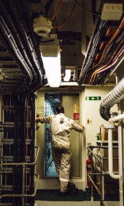
Of course, it’s a really dangerous part of the ship that demands utmost care. I feel privileged being allowed to explore down here, but as I mentioned before – with noise cancelling earmuffs and camera gear in hand, it’s a tricky place for me to work. Before you’re allowed to set sail, you need to attend a safety briefing and by far the most harrowing pieces of equipment for all visitors are the watertight doors. They are extremely heavy mechanical doors that are used to prevent flooding from one part of the ship to the other in case of an emergency. During your briefing you see various gory images of accidents involving these doors – you operate them with a lever and they move pretty slowly, but you most certainly don’t want to take any risks when stepping through them! I find most visitors (including myself) try to avoid using them where they can, but down in the engine rooms they’re a necessity. I’ve become pretty used to them now, but I have to admit the hairs on the back of my neck still tingle when I have to put my arm through to hold the lever as I step through these automatically-closing doors.

A watertight door opens slowly as Lee heads towards the control room...

A watertight door opens slowly as Lee heads towards the control room…

Heading back up a few flights of stairs, past the science teams cutting and analyzing cores in the ‘wet lab’ and through the ‘hanger’ and you’re on the aft deck. This is where I spend the majority of my time, trying to capture images in the heart of the action.

All hands on deck as the vibrocorer requires attention.

All hands on deck as the vibrocorer requires attention.

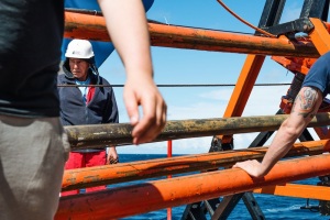
This is where all of the ‘hands on’ science happens. Here the crew, the British Geological Survey (BGS) engineers and the science teams work together to operate the ‘vibrocorer’ and ‘piston corer’, which are lowered into the sea to retrieve samples from the ocean floor. It’s another fascinating area for photography, and it’s a great feeling standing out here in the bracing sea air as seabirds fly past.

A young gannet soars above the aft deck.

A young gannet soars above the aft deck.

John sends tools up to a colleague on the a-frame above before carrying out some maintenance.

John sends tools up to a colleague on the a-frame above before carrying out some maintenance.

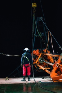
I’m out here a lot, straddling different shifts at different times to capture a true picture of life on deck. As soon as night falls, it becomes a totally changed place. Floodlights light the deck, illuminating seagulls in the darkness as they speed past. As the ship bobs up and down, and there’s darkness as far as the eye can sea, looking over the side is quite an eerie but humbling experience. You try not to think about ‘what if’ but inevitably end up considering how different it would be out there compared to a well lit and pleasantly warm swimming pool where you do your marine survival training.

Standing on the Aft Deck, looking out into the dark...

Standing on the Aft Deck, looking out into the dark…

Activity on the aft deck, much like the rest of the ship, revolves around the scientific operations. It’s a hive of activity once we’re about to deploy/retrieve the corers; teams appear from every corner of the ship and it’s all go, but during transits between sites it can become really quite deserted. The crew return inside, the BGS engineers disappear into containers to service equipment, and the science teams head to the labs. There’s a very set routine on board, and it’s really interesting being able to observe it – at times, especially during longer transits, there might only one person left on deck… and that’s usually the lone photographer!

John passes ropes up to his colleague while the Vibrocorer is on deck.

John passes ropes up to his colleague while the Vibrocorer is on deck.

Of course, the quietness is always short-lived and before you know it, the crew reappear, ready to redeploy. One thing that strikes me about everyone on board, especially the crew, is the importance of positivity. A good sense of humour is a key attribute for anyone working at sea. When you’re living in a confined space, working in a hazardous and strenuous environment with the same people, day in day out for weeks or months at a time, humour diffuses tensions, passes the time and helps teams work together. That means there’s always a lot of good ‘banter’ out on deck, and for days when humour doesn’t quite cut it, there was always the punch bag hanging in one of the storerooms!

When the gym is busy, or when rowing and running won't cut it, there's always the punch bag.

When the gym is too busy, or when rowing and running just won’t cut it, there’s always the punch bag.

Now to where the science happens – the ship’s labs. Head back in from the aft deck, through the hanger, and the first of these is the ‘wet lab’. Where fresh cores are processed.

Dave labelling cores in the wet lab...

Dave labelling fresh cores in the wet lab…

Head through there and down a corridor and you’ll reach the ‘dry labs’ where banks of computers and geophysical equipment are being studied meticulously, and, if you time it right, there’s usually a slab of Toblerone or a packed of Haribo being shared around…!

Geophyical watch…

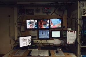
At the back of the dry lab, a CCTV station allows you to keep an eye on things.

At the back of the dry lab, a CCTV station allows you to keep an eye on things.

Before I wrap this up, I should point out that one of the reasons I love what I do is my clientele. Scientists (at least the ones I’ve met) tend to be very positive, welcoming and down to earth people, so it’s a pleasure dealing with them on a day-to-day basis.

Part of the science team back at the start of the cruise.

Part of the science team back at the start of the cruise.

One reason why this area of photography/filmmaking was a natural progression for me, is it followed on from my own scientific background. Having studied glaciers in Iceland and Greenland during undergrad and postgrad research, I have a fairly broad understanding of a lot of the topics that the Britice-Chrono team are investigating. This is essential for knowing when and where to shoot, and definitely helps me understand the teams’ enthusiasm for mud!

‘Oooooh’


Connect with Alex on social media:
Instagram: @alexinglephoto
Twitter: @alexinglephoto
Facebook: http://facebook.com/alexinglephoto


Cruising Doggerland

By Dave Roberts (with selected photography by Alex Ingle)

Doggerland

Doggerland

The last week has seen the start of the epic trek north to south from Shetland to the Dogger Bank in the southern North Sea.
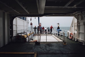
We spent the first 2 days looking at some enigmatic grounding wedge features on the sea-floor just west of the Norwegian channel where the British and Norwegian Ice sheets battled it out for supremacy during the last cycle. We also stepped boldly into the unexplored world of outburst floods and drowned coastlines with a some incredible seafloor geomorphology adding to the ice sheet story in relation to the uncoupling of the two ice sheets. Unbelievable geomorph!

This slideshow requires JavaScript.

From the Norwegian Channel we headed SW towards the Moray Forth running a 100mile survey and coring transect NW to SE over a spectacular series of moraines before heading into the central North Sea and the urban heartland of the North Sea oil fields around Shearwater and Erskine. Our goal was the Great Fisher Bank (that renowned last bastion of the British Ice Sheet) where we enjoyed a cracking day out sampling Holocene sand and the arrival of a racing pigeon called Terry from Thurso. Needless to say, Terry proved more interesting than the seafloor that day!

This slideshow requires JavaScript.

The great odyssey to the Far East was followed by 3 epic days surveying and coring east of the Firth of Forth and then down the east coast from Berwick to Sunderland chasing the imprint of the North Sea lobe. Moraines, deltas, eskers, outwash fans and tunnel valleys littered the bed of the Forth system; all soaked in metres glorious glacial sediment. Better was to follow as we moved south along the Northumbrian coast with the resplendent Whin Sill fracturing the seafloor and grounding zone wedges plastered on to the bedrock. There were also superb, quiet seafloor basins revealing the multi-coloured, muddy barcodes of the deglacial story of the Forth, Tweed and Tyne Ice Streams.

This slideshow requires JavaScript.

The final push now. One week to go and on to Dogger Bank for the next two days. Can we prise out the some glacial secrets from beneath that sandy veneer? Huge sand banks seem to guard its peripheral moat warning against trespass, but we are committed now and on to its shallow, upper surface. Our early cores are showing promise; we will see. Hopefully, our target sites in the Humber and Wash area will bring a pot of glacial gold at the end of a cracking month at sea. Then home.

North, beyond Shetland: A Daysleeper’s diary

by Tom Bradwell (Day 15: Friday, 04:44) (with some photography by Alex Ingle)

IMG_5834

The last time we ventured into Shetland territory it was in pursuit of far-travelled rocks laid down by the last ice sheet, strewn across hard-to-reach islands – Foula, Papa Stour, Out Skerries, to name just three. Our successful 10 island-tour of Shetland took place in 11 carefully planned days in May last year, when the 6-strong team worked from dawn til dusk to ensure that they didn’t return home empty handed. Those precious rock specimens have since been analysed at Glasgow University; their exposure age is helping to unravel the ice sheet history of Shetland and the surrounding area. This time the Britice-Chrono team are on the high seas, aboard the RRS James Cook, looking for glacial seabed mud and ice sheet imprints along the extreme edge of NW Europe, from the Outer Hebrides to the Norwegian Channel.

This slideshow requires JavaScript.

In this part of the UK, in July (at 61.5 degrees N and still within the offshore Exclusive Economic Zone) dusk stretches beyond midnight and the sun reappears before 3 am, after only the briefest of nights. That being said, working on the night shift is still a challenge. The geophysical data collection and seabed coring programme on the James Cook works 24/7. The ship’s crew operate on 4-hr ‘watches’, and the science team are divided into day and night shifts (8am to 8pm) to allow around-the-clock working. Punctual, brief, morning and evening meetings allow seamless handover between shifts, an update on the day’s progress, and an all-important weather forecast for the next 48 hrs. Day and night shifts for the science team are similar in content but different in the details. Apart from the darkness, the cold, the nocturnal fatigue and the daysleeping, we have dinner for breakfast and sometimes breakfast for dinner; which mixes up the body’s normal everyday cycle and turns the daily routine on its head. But after 2 weeks on the night shift, having a roast beef lunch at midnight seems almost normal. Although going to bed when the sun is at its warmest will never feel quite right to me. And the AM vs PM confusion is always there, nagging away.

This slideshow requires JavaScript.

As we collect geophysical data, recover seabed samples and describe cores well into the night, the daysleepers perform the same rituals as the nightsleepers but just in a different time zone. We say ‘good morning’ to people instead of ‘goodnight’; we cheerfully get down to work on Wednesday night and carry on into Thursday morning; we relax on deck after some ‘early evening’ exercise; and drink a beer instead of pouring that first cup of coffee. But perhaps my favourite bit is not really ever knowing what day of the week it is. Waking up after a full ‘night’s’ sleep to find it’s still the same day as when you went to bed. Confusing, but curiously liberating!

Anyway, back to the science. Yesterday’s leg of the cruise took us 60 nautical miles (or roughly 111.11 kilometres) north of Muckle Flugga lighthouse, Shetland’s northern tip – a point on the Greenwich meridian still in UK waters but on the same latitude as Narsarsuaq Glaciers in east Greenland and Suduroy in the Faroe Islands. We took 9 seabed cores during a 12 hour transit back towards Shetland, each one penetrating different sediment, and each one hopefully holding its own clues as to when the last ice sheet retreated and when sea levels rose. The spectacular sequence of moraine ridges on the seabed NE of Shetland is unique within the British Isles, both in its unusual shape and the number of landforms preserved. Although we’ve known about the moraine pattern for a while, and what it means for the last ice sheet to cover Shetland and the northern North Sea, the age of these features remains elusive. What we find when we analyse these cores will hopefully help clear things up.

For me, the crucial part of the Britice-Chrono project comes when linking geological evidence onshore and offshore — something that has often proved difficult in the past. As an Earth scientist, interested in glacial processes, the distinction between terrestrial and marine is a blurred and relatively unimportant one. A bit like the difference between morning and evening when working the night shift at this latitude…

A Photographer’s Perspective…

 A series of guest blogs by Alex Ingle, resident filmmaker and photographer.


DSC_6890

A new perspective on things.

Now that we’re done with introductions (blog here), and as we’re just about at the halfway point of the cruise, I thought I’d share some insight into life on board the ship from a photographer’s perspective; what it’s like being the ‘odd one out’ and some of the unique challenges that this environment presents me with.

Processed with VSCOcam with g3 preset

Docked in Southampton, getting some final shots on the evening before we left.

Life on board a research ship is a 24/7 operation, there’s always something happening, people are always working, and there’s always a photograph opportunity or two. This is the first challenge for me, whereas the science teams and crew have set shift patterns that rotate every 12 hours, I’m in charge of my own schedule and must decide when and where to photograph. I could choose to only shoot on blue-sky days for a few hours and spend the rest of my time with my feet up, but this wouldn’t be a true representation of ship life (and, honestly, it wouldn’t be much fun). In order to portray a more realistic picture, and to document the ups and downs which come with this line of work, it’s my job to experience both day and night shifts, across the whole ship come rain or shine.

DSC_7730

This far north, when the sun rises early; the photographer stays up late.

Sometimes I’ll be out on deck at night – sitting with the crew as they exchange stories during horizontal rain, watching the science teams jump into action as fresh cores are hauled up from the sea floor in the early hours. At other times I follow the day shifts – the chefs and porters in the galley, the engineers beneath deck or the science teams processing cores in the labs. Some days I do a bit of both. It’s an intense environment, especially when the weather takes a turn for the worse, and making sure that I’m always in the right place at the right time to get the shot is a constant challenge, as is making sure I get enough sleep in between it all!

Vibrocorer repairs on the aft deck.

Vibrocorer repairs on the aft deck.


However, by far the biggest challenge for me revolves around safety. Shooting an assignment in a complex and dangerous offshore environment requires much more consideration than most of my work on dry land. Traversing glaciers, or navigating gorges whilst following scientists isn’t without its dangers, but here on the ship you really have to stay on the ball at all times. This is particularly challenging as a photographer/filmmaker coming into an environment like this for the first time. Now I have the benefit of last year’s offshore experience, but when you first step on board it’s not difficult to get caught up in a shot without realising that you’re in danger of falling overboard or getting caught in a winch cable. With ‘viewfinder vision’ it’s all too easy to forget what’s happening around you while you’re focussed on getting the shot.

The aft deck.

The aft deck.

You find photo opportunities wherever you look, but you have to have eyes on the back of your head, and be completely aware of everyone and everything around you. This is especially the case beneath deck in the engine rooms. Down there you wear noise-cancelling earmuffs, it’s deafening without them. Losing one of your senses makes a dangerous place even more so, particularly when navigating through watertight doors and past moving machinery. But, if you keep your wits about you, listen to the advice of the crew, drink plenty of coffee and make sure that when one eye is behind the viewfinder, the other is always focussed outside the frame, then it’s a thrilling place to work.

Another challenge that springs to mind involves capturing 24/7 coring operations on film. Being immersed in this environment, it’s easy to get a sense of scale first hand, but it’s quite a logistical and technical challenge to capture that on film for others to see. The fairly straightforward task of shooting time-lapse sequences suddenly requires a lot more thought when you’re on a ship. In addition to the usual technical considerations, you need to consider how high the swell might get, strapping everything down with cable ties and ballast and making sure it’s protected from the elements. I don’t attempt these long time lapses very often out here largely because of the impact it has on my sleep – I tend to lie in bed imagining my gear out on deck sliding overboard, and end up checking on it every hour throughout the night. I haven’t (yet!) encountered any major issues but since I shot a few successful 24-hour time-lapse sequences of ‘vibrocoring’ on JC106 last year… I don’t think there’s any need to tempt fate (or disturb my sleep) this time around!

On a side note, being the one behind the camera means there’s not a lot of photos featuring me – the exception being the slightly unflattering ‘checking to see if the GoPro is running during a time lapse’ shot:


This slideshow requires JavaScript.


Connect with Alex on social media:

Instagram: @alexinglephoto
Twitter: @alexinglephoto
Facebook: http://facebook.com/alexinglephoto

A Perfect Core……..

By Margot Saher, Dave Roberts and Rich Chiverrell (Photography by Alex Ingle)

Darkness. A great mass of ice overhead. The eerie rumbling of a large, uncompromising mass, slowly but steadily on the move. Below a thick layer of stiff red sediment, ground off the red bedrock, crushed and churned into a lumpy, sticky blanket of glacial till.

Dark coasts

Dark coasts

What would later be called Cape Wrath was only miles to the south, but there was no cape yet. Just the grinding of slow and unforgiving ice moving north into the North Atlantic. But the times were changing. The sun gained in strength, atmosphere and ocean started to warm and the gigantic ice mass, later to be known as the British-Irish Ice Sheet, was in decline. As its surface melted, more water reached its bed, and it began to slide helplessly over its own sediments. Slowly it thinned, and retreated in the direction of the Scottish mountains with the ocean lapping relentlessly at its edges.

There seemed to be no hope, but the ice sheet made one last bold dash towards the edge of the continental shelf before it faltered. The recently deglaciated seabed and freshly deposited grey ocean sediments were bulldozed and overrun again by ice on the move, and buried once more in a blanket of red till. Linear ridges (moraines) marked the limit of this temporary re-advance. But it was only a death throw; the re-advance didn’t get far. The ice sheet’s days were numbered. The advance stopped, and turned into irreversible retreat.

A geophysical search for the perfect core.......

A geophysical search for the perfect core…….

Against a backdrop of rumbling, calving icebergs, station JC123-048VC slowly became ice free, as the snout of the ice sheet moved back over the site. A cold, shallow sea took its place; first, still close to the snout of the ice sheet, where streams of meltwater rushing into the waiting sea water lay down a blanket of coarse sand. As the ice retreated further, taking the meltwater streams with it, the sea fell silent. Only fine sediments spat out into suspension by the dying ice sheet made it to our site, slowly covering it in a thick, grey blanket.

This slideshow requires JavaScript.

The ice sheet sent a final message as the ice margins retreated south towards the land; a message from an iceberg. As it passed, melting, overhead of station JC123-048VC, pebbles slipped from its icy grip. They plummeted into the depths, impacting into the soft fine clay sea bed. As soon as this excitement started it was over, and the pebbles were slowly covered by more of the same grey clay.

With the great weight of the ice gone, the Earth’s crust rose like an ancient giant from its slumbers, pushing the Scottish continental shelf closer to the sea surface. Over time, the waters shallowed, and the seabed currents became stronger. The last vestiges of the glacial seafloor were scoured by contour currents, which deposited the spoils of an energetic coast on the eroded sediment below. Millennia later coarse sand and shell debris formed a layer of several inches thick. And then on Sunday the 12th July 2015 all changed.

This slideshow requires JavaScript.

There was an unfamiliar thud, and then the uncanny sensation of a vibrating tube burrowing into the sediment from above. It cut through the sand in a jiffy, passed the pebbles, and into the soft clays. The tube slid through it like a hot knife through butter. No struggle with the coarse sands lain down by meltwater streams either, only slowing on reaching the stiff, red till. It battled its way into it for a meter and a half. Then the friction became too much. The vibrocorer stopped, and then the whole tube, now full of sediment, was pulled back up to the sea surface, and hoisted back up onto the deck of the RRS James Cook, the ship it had come from. Peace returned once again on to the sea floor, at core site VC123-048VC, a few miles north of Cape Wrath, on the northwestern edge of Scotland; a land mass now devoid of ice sheets and glaciers.

The core came on board and was cut into sections, labelled, scanned, and split. Finally, we, the scientists who had planned the project, planned the cruise, sailed all the way from Southampton to Cape Wrath, and waited for the British Geological Survey (BGS) to deliver the core, first laid eyes on the sediment. The story was there: a stiff basal till deposited beneath the ice sheet; fines marking the first incursion of the sea; further glacial till documenting the ice re-advance, meltwater stream sediments deposited in front of the retreating ice margin; the fine clays deposited when the ice began to recede southwards containing drop-stones from the icebergs, and the marine sand of the modern seafloor. That was what we had come for. And this was the 48th core; none of the previous 47 had told the story of the vanishing British ice quite this clearly.

This slideshow requires JavaScript.

Hopefully we’ll be getting more cores like this in the coming three weeks of the cruise. We need this story told in every sector of the British-Irish continental shelf. Only then will we have what we set out for: the complete saga of the Last British-Irish Ice Sheet.

Gripped in the jaws of the Minch

By Richard Chiverrell and Tom Bradwell (photography by Alex Ingle)

1292 km, 51 cores, 177m of sediment, not a bad haul

1292 km, 51 cores, 177m of sediment, not a bad haul


We, the science crew of RRS James Cook Cruise JC123, sailed from Southampton Friday 3rd July bound for the last three transects of the NERC funded Consortium Britice-Chrono, our aim is to work out the timing of the last deglaciation of Britain and Ireland. After a quick stop outside the Solent to test the BGS vibrocore we made hast (10 knots) northwards through the North Sea running geophysical surveys for the North Sea sector (Transect 2) as we went, and in the early hours of Monday 6th July we rounded the northern tip of Scotland on schedule for our speedy (19 knots) tide-assisted passage through Pentland Firth between Orkney and the Scottish Mainland onwards to Transect 8 and the delights of the Minch palaeo-Ice Stream extending north from Skye between the Scottish Mainland and the outer Hebrides towards the edge of the continental shelf and the North Atlantic.

This slideshow requires JavaScript.


The Minch seaway ~28-25,000 years ago received ice flow from the major fjords in NW Scotland feeding palaeo-ice stream, which extended north and northwest across the continental shelf. This ice stream dominated the northwestern sector of the British Ice Sheet (BIS). The land- and sea-scape probably developed over multiple glacial episodes, but the sea floor landforms and uppermost geology reflect the most recent deglaciation after 25,000 years ago. The aim of Britice-Chrono is to work out the timescale for this deglaciation, and this has involved fieldwork on land, dating outwash deposits on the Isles of Lewis, Skye and on mainland, and glacially eroded bedrock and boulders across the region. The offshore phase of this research has occupied us, so far, for the last seven days and nights, and involved surveying the sea floor for the morphology and the sediments using acoustic sounding techniques, but critically sampling the sea floor sediments. We have two coring systems on board, a percussive vibrating corer that can sample down to 6 m below the sea bed penetrating the tough materials laid down beneath and in front of former glaciers, and a gravity powered piston corer capable of sampling up to 18m in softer sediments. Our aim is to find shells in these glacial sediments to radiocarbon date and work out the timing of deglaciation.

This slideshow requires JavaScript.


The success of the efforts for both our cruises relies on the excellent 24 hour work ethic, diligence and company of the cruise team, science crew, BGS and NOC Piston coring teams and the RRS James Cook captain and crew, all of whom do everything they can to help us. The middle 2-3 days of T8 were particularly nerve-wracking as the BGS crew toiled night and day to fix a particularly truculent problem with the vibrocorer, part of the solution to which lay in finding and removing an electrical break in the 1500 metres of cable that winches the BGS vibrocore to and from the sea bed. Thankfully time was spent obtaining important piston cores in the inner Minch and collecting valuable geophysical data, as the BGS team worked around the clock. As ever in Britice chrono’s experience, the BGS team, had everything needed on board to solve the problem, and cheers greeted the announcement of ready to go, and there followed ‘an in at the deep end’ test of the repair in 500-600 metres of water off the continental shelf fronting the Minch ice stream. Success, with 4.14 metres of glacimarine muds recovered, and on leaving the waters of T8 a further 11 vibrocores were recovered containing the key shell-rich glacimarine and subglacial muds our project requires.
Calm seas, epic sunsets

Calm seas, epic sunsets


Looking back on the Minch experience, it is certainly one of the prettiest (former) ice streams we have worked on during the Britice-Chrono cruises, with land in view and visiting the Inner Hebrides passing the Isles of Skye, Lewis/Harris and Raasay amongst others. The leg has been a considerable success, we have collected 1292.6 km of geophysical data (multi-beam and sub bottom profiler), 51 sediment cores (39 vibrocores, 12 piston cores) and 177.2m in vertical sediment profile; who said the Minch was a small ice stream? Our travels have taken us from Raasay Sound in the south over the edge of the continental shelf at 59° 15’ N, and into near shore waters fronting Cape Wrath and the Summer Isles. The answers to the Britice-Chrono geochronological questions must wait on many months of laboratory analysis, but we leave the Minch with all teething troubles behind us, and a growing bounty of cores in the locker. We are ready for the delights of Shetland…!
A 12m piston core (Tom Bradwell for scale ~ 1.74m)

A 12m piston core (Tom Bradwell for scale ~ 1.74m)

Here we go…

Here we go, here we go, here we go, HERE …WEE …GOoooo…..

The RRS James Cook, towards the end of mobilisation. Just the ‘Vibrocorer’ is left standing proud on the dock – ready to be lifted into position.

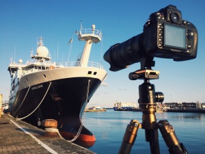
The Royal Research Ship (RRS) James Cook gets ready for her geophysics and coring cruise as part of BRITICE-CHRONO’s investigations into the speed of ice sheet retreat. Just back from Mexican waters she needs to prepare for the North Sea and the continental shelf and fjords of northern Scotland. Our resident filmmaker for the cruise, Alex Ingle, has captured the mobilisation process. Witness much dockside crane-work at the National Oceanographic Centre in Southampton, loading the drilling rigs (vibro- and piston corers) and containers of kit including our impressively-refurbished containerised core scanning laboratory, which comes complete with scientist Sally Morgan. So much deck manipulation was required that a small ‘cherry picker’ was craned onboard for the delicate manoeuvring. Food and water for a one month journey also made it onboard, although I noted at breakfast this morning that we are drinking bottled water from Mexico, very nice too.

This slideshow requires JavaScript.

Mobilisation of the science team was much easier, with 25 of us travelling by train, plane, and automobile and climbing the steep gangway. This brings the ship’s complement to 52, all of whom are ready for a voyage of some discovery. Colm is our captain of science for the trip (Principal Scientific Officer) and is hoping for a nice and steady start to our adventure. For me, the long-awaited cruise started on my birthday, very fitting timing and more so because it was also on my birthday, high in the Italian Alps, that I first learnt that our BRITICE-CHRONO project got the go-ahead when NERC chose to fund it. Clearly a precedent has now been set for sizeable scientific treats on my birthday that I hope to enjoy in the future years. I am just back from a marvellous lunch, with stop-press news, we have now run out of Mexican water, our new supplies are from Conwy in North Wales.

The science team watch as the Vibrocorer is lowered into the water for a test core.

The science team watch on in anticipation as the Vibrocorer is lowered into the water for the first time this cruise.

So we finally set sail 9am Friday 3rd July, setting off on a 3 day transit up the east coast of England and Scotland, through the hazardous Pentland Firth, westwards across Scotland’s north coast to our first target cores near Cape Wrath. Let there be shells of treasure in them there cores……..

Chris Clark.

A Photographer’s Introduction

A series of guest blogs by Alex Ingle, resident filmmaker and photographer.


Alex porthole

To begin with, I guess an introduction is in order. My name’s Alex Ingle, a filmmaker/photographer from Stirling, Scotland, specialising in multimedia outreach for scientific research and field expeditions. I joined the Britice-Chrono team in 2014 to document their first research cruise, and, after a very successful trip all round, I am delighted to be back on board. On that note, a sincere ‘thank you’ is in order to everyone for inviting me back!

On the James Cook I’m in a pretty unique position to be able to experience and document all aspects of ship life, floating between day shifts and night shifts on all parts of the vessel as the crew and science teams work around the clock. From the chefs in the galley to the engineers beneath deck, people from all walks of life work together to make research projects like this happen, and I’d be delighted to offer some insight into this intriguing world through this series of blogs. Working in this environment presents some pretty unique challenges for me as well, which I’d also like to share with you over the coming weeks.

Blog 1 - Vibro repair
Now that I’m settled in – my camera gear is unpacked, the BGS equipment is nearly mobilized and ready to go, and we’re waiting for the science team to arrive – I think I’ll take this opportunity to paint a brief picture of my work, and explain how on earth I ended up working on research ships…!

Let’s start way back. I grew up in rural Scotland, and have lived there for much of my life since. I’ve never had any formal photography training, but when I think back, my love of photography (which later transitioned into filmmaking) began when I was five. I was given my first disposable film camera on holiday in France, and, after finding some catfish in a pond, used an entire roll of film within a few short minutes. That’s where it all started, when a love of wildlife overlapped with a newfound hobby. As a kid, I dreamt of becoming a nature photographer. I always had my head buried in my collection of National Geographics and ‘Wildlife Fact Files’ and watched all of the old BBC natural history documentaries religiously. I spent my spare time outdoors with my Dad’s Olympus OM1 as well as countless Polaroids and disposable cameras, stalking family pets and wild birds as I learned the art of photography through trial and error.

Despite those early aspirations, it’s only in the last few years that photography/filmmaking has become more than just a hobby. In brief, over the course of several years, I travelled to Iceland and Greenland to research glaciers, ice caps and the impact of climate change. This was to be a turning point in both my personal life and career, but not as I could ever have expected. In Iceland I met a girl who later became my wife (it’s a long story involving glaciers, kæstur hákarl [rotten shark] and a chance encounter on the country’s southern coast) and in Greenland I met a photographer and filmmaker called Chris Linder. At that point, whilst camped in a remote corner of Greenland, I finally decided to take the plunge and turn filmmaking and photography into a career…. and I haven’t looked back since.

Blog 1 - vibro repairs 2

Combining my passion for science with a love of filmmaking and photography, I began working with researchers across the UK to produce multimedia and to run outreach campaigns that would engage with the public by showing the ‘human face’ of science. This unusual career path has taken me to some remarkable places, but, until 2014, these were exclusively on dry land. Early last year, after a discussion with Chris Clark, Britice-Chrono’s Principal Investigator, I received my first offshore assignment – to document the life and work of those onboard the James Cook (JC106).

Blog 1 - Aft deck shot
I’ve got to admit, it was a daunting task having only ever been on rather tame ferry crossings before but it turned out to be an awesome experience which has led my work down a really exciting path. Over the coming month, as well as shooting some documentary footage for Britice-Chrono, I’ll be spending time on board developing some of my own work during the first of three offshore artist’s residencies. Last time, I found my sea legs pretty quickly and avoided any sea sickness… here’s hoping for the same this time around!

Collage


Connect with Alex on social media:

Instagram: @alexinglephoto
Twitter: @alexinglephoto
Facebook: http://facebook.com/alexinglephoto