Category Archives: Terrestrial geology specific issues

End of an Era ……….for the mighty British-Irish Ice sheet and our mammoth fieldwork campaign.

By Chris Clark (with photography by Alex Ingle)

Voyages around a former ice sheet.....

Voyages around a former ice sheet…..

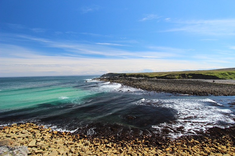
After a decade of dreaming and years of planning our team of 40 data-hungry geoscientists were given the scent and released from their cages (~desks) with the audacious task of blitzing the whole ice sheet to find samples for dating its retreat. This started in November 2012 in a grey drizzle at Seisdon sand and gravel quarry near Stourport and finished 09:30am 1st August 2015 in bright sunshine when we extracted our last sample, a seafloor core, from the Cleaver Bank in the southern North Sea. It really has been an epic two and half years witnessing the Terrestrial Team with sun-cream in the Scilly Isles to shivers in Shetland, and with dressing gowns in Donegal to JCBs in Norfolk. We really did covered the ground from south to north and east to west and snuck in 28 – yes 28 – different islands of Britain and Ireland, including Scilly Rock and Foula. When samples were not easy to spot and grab, we used radar, seismics and some occasional guesses to work out where to dig with shovel or digger or to core the hidden sediments. It is not quite true that no stone was left unturned, but I have been amazed at how close we got to that, thanks to some amazing levels of energy and motivation; it is indeed lucky that our team displayed traits of obsessiveness and kleptomania when it came to sampling. Bloody well done to all.

This slideshow requires JavaScript.

So our very last sample (core 179-VC) on BRITICE-CHRONO has now been collected, marking the end of Cruise Two on RRS James Cook. Even though we never got to shout ‘One hundred and …eighty’ it is more than we had planned. We have sailed, steamed, or dieseled 8971.65 kilometres, taking in Skye, Rona, Shetland, and more North Sea banks including (the infamous Dogger) that you could shake a stick at. We have sampled deep (525 m) and very shallow (19 m), and calm and troubled (force 7). Our ship-track might look erratic to some but, as they say in marketing non-speak, it comprises a subtle blend of caution and well-planned targets with a hint of adventure and wild abandon yielding a truly inspiring collection of mud and sand to sate the yearnings of the most inquisitive discerners of ice sheet curios.

The loot under the care of Team Marine (Lou and Margot)

The loot under the care of Team Marine (Lou and Margot)

The haul, now sat in our refrigerated lorry-container and packed in plastic tubes was obtained by lowering our vibro- and piston corers through 18,891.4 metres of seawater and extracting over half a kilometre of sediment (Rich says 542.4 m). As well-known, of course, it is not the length that counts, but the quality. It will be some time however before we know which cores, places and transects yield the best shells and forams for dating, but Margot and Lou have already bagged, sifted and labelled the celebrity shells which we think have the best stories to tell….’well there was this bloomin’ huge great wall of ice that kept crashing down, and would you believe what happened next….’.

Science crew of the RRS James Cook cruise JC123

Science crew of the RRS James Cook cruise JC123

Thanks to Colm and his science team, the Captain and crew and the geological survey coring teams, and the weather, some good planning, crazy hunches and some luck, this scientific cruise has been a great and enjoyable success. We have a mammoth payload that we hope will provide a legacy of new information for decades. It has been a pleasure having Alex, the ever-present black ninja-photographer on-board, – he stalks, clicks and then runs – in his quest to document our highs, lows and silly moments. Hopefully you have already seen much of his work.

This slideshow requires JavaScript.

We set out to do 50 years work in five. Taking this cruise with last year’s, which circumnavigated Ireland, along with our >300 person-days of terrestrial fieldwork we have bagged around 15 tonnes of samples for dating and I hope you agree that we have been around a bit. Sorry if we missed your patch, why don’t you have a go? It is an end of an era for our sampling effort. As project leader, I now breathe a large sigh of relief that it is over and has gone so well, phew and phew again. There is a tinge of sadness though, that we all feel as the fun, bonhomie and making of new friends on hard-won field exploits has now ended. No more pie shops or sneaky pints. Team Terrestrial (Rich and his gang) and Colm’s Marine Crew, can now stand-down to great applause. Derek’s Geochron Team have their work cut out to carefully analyse all the samples and then our Transect Leaders (Tom, Dave, Rich, James, Colm, and Sara) will rise to the challenge of making sense of it all and telling us the story that the shell started to blurt out.

Taking things one day at a time

Taking things one day at a time

Chris Clark, signing off on behalf of BRITICE-CHRONO, currently steaming 11 knots, homeward bound, over the Tea Kettle Bank of the southern North Sea. All cores logged and packed and the pinging geophysics finally turned off.

North, beyond Shetland: A Daysleeper’s diary

by Tom Bradwell (Day 15: Friday, 04:44) (with some photography by Alex Ingle)

IMG_5834

The last time we ventured into Shetland territory it was in pursuit of far-travelled rocks laid down by the last ice sheet, strewn across hard-to-reach islands – Foula, Papa Stour, Out Skerries, to name just three. Our successful 10 island-tour of Shetland took place in 11 carefully planned days in May last year, when the 6-strong team worked from dawn til dusk to ensure that they didn’t return home empty handed. Those precious rock specimens have since been analysed at Glasgow University; their exposure age is helping to unravel the ice sheet history of Shetland and the surrounding area. This time the Britice-Chrono team are on the high seas, aboard the RRS James Cook, looking for glacial seabed mud and ice sheet imprints along the extreme edge of NW Europe, from the Outer Hebrides to the Norwegian Channel.

This slideshow requires JavaScript.

In this part of the UK, in July (at 61.5 degrees N and still within the offshore Exclusive Economic Zone) dusk stretches beyond midnight and the sun reappears before 3 am, after only the briefest of nights. That being said, working on the night shift is still a challenge. The geophysical data collection and seabed coring programme on the James Cook works 24/7. The ship’s crew operate on 4-hr ‘watches’, and the science team are divided into day and night shifts (8am to 8pm) to allow around-the-clock working. Punctual, brief, morning and evening meetings allow seamless handover between shifts, an update on the day’s progress, and an all-important weather forecast for the next 48 hrs. Day and night shifts for the science team are similar in content but different in the details. Apart from the darkness, the cold, the nocturnal fatigue and the daysleeping, we have dinner for breakfast and sometimes breakfast for dinner; which mixes up the body’s normal everyday cycle and turns the daily routine on its head. But after 2 weeks on the night shift, having a roast beef lunch at midnight seems almost normal. Although going to bed when the sun is at its warmest will never feel quite right to me. And the AM vs PM confusion is always there, nagging away.

This slideshow requires JavaScript.

As we collect geophysical data, recover seabed samples and describe cores well into the night, the daysleepers perform the same rituals as the nightsleepers but just in a different time zone. We say ‘good morning’ to people instead of ‘goodnight’; we cheerfully get down to work on Wednesday night and carry on into Thursday morning; we relax on deck after some ‘early evening’ exercise; and drink a beer instead of pouring that first cup of coffee. But perhaps my favourite bit is not really ever knowing what day of the week it is. Waking up after a full ‘night’s’ sleep to find it’s still the same day as when you went to bed. Confusing, but curiously liberating!

Anyway, back to the science. Yesterday’s leg of the cruise took us 60 nautical miles (or roughly 111.11 kilometres) north of Muckle Flugga lighthouse, Shetland’s northern tip – a point on the Greenwich meridian still in UK waters but on the same latitude as Narsarsuaq Glaciers in east Greenland and Suduroy in the Faroe Islands. We took 9 seabed cores during a 12 hour transit back towards Shetland, each one penetrating different sediment, and each one hopefully holding its own clues as to when the last ice sheet retreated and when sea levels rose. The spectacular sequence of moraine ridges on the seabed NE of Shetland is unique within the British Isles, both in its unusual shape and the number of landforms preserved. Although we’ve known about the moraine pattern for a while, and what it means for the last ice sheet to cover Shetland and the northern North Sea, the age of these features remains elusive. What we find when we analyse these cores will hopefully help clear things up.

For me, the crucial part of the Britice-Chrono project comes when linking geological evidence onshore and offshore — something that has often proved difficult in the past. As an Earth scientist, interested in glacial processes, the distinction between terrestrial and marine is a blurred and relatively unimportant one. A bit like the difference between morning and evening when working the night shift at this latitude…

Minching about on a sunny Isle of Lewis

By Rich Chiverrell

Port Skigersta delta

Port Skigersta delta

One of the smaller ice-masses draining the former British-Irish Ice Sheet, the Minch palaeo ice stream drained much of the NW sector of the British–Irish ice sheet (∼15,000 km2) feeding sediments to the large Sula Sgeir fan fronting the continental shelf. But if this is small, standing on the east coast of Lewis (Outer Hebrides) looking across the sunlit, blue seas and skies east to the feeder fjords and mountains of the Summer Isles and Wester Ross helps one visualise how large this former ice sheet really was. Our aim for this ongoing Briticechrono Transect 8 fieldwork was to secure a series of targets for Optically Stimulated Luminescence (OSL) dating from outwash sands from Lewis, one of the outermost land-masses on the western flank of the Minch Ice Stream. This work will support previous sampling efforts targeting boulders on the Scottish Mainland and the Hebrides for cosmogenic nuclide dating. Previous OSL sampling had targeted the inner sector of the Minch on Skye and north of Ullapool. The team (Rich Chiverrell, Matt Burke, OSL Postdocs Rachel Smedley and Alicia Medialdea) set off first thing on Tuesday morning to join Transect Leader (Tom Bradwell) on Lewis. Departing a cloudy Manchester via Glasgow Airport we landed before lunchtime to blue skies, sunshine and searing temperatures at Stornoway Airport.

This slideshow requires JavaScript.

Inspired by our surroundings, the weather and the prospect of excellent sediments the four newcomers sped off to meet up with advance team Tom Bradwell, Adrian Hall and Maarten Krabbendam (from the Netherlands) at Port Skigersta in the far north of Lewis. The site an embayment on the western flank of the Minch Ice Stream gave stunning views across the water back to the ice source areas in western Scotland and beautiful turquoise seas. The sediments were very impressive with the sequence a stacked delta sequence with steeply dipping fore-set sands capped by top-set horizontally stratified gravel. Intriguingly the basal delta is buried by laminated bottom-set muds, in turn buried by a second delta fore-set and top-set couplet. The repeating delta suggests changes in water level probably lake level, dammed between the ice stream and bedrock rise into Lewis. We sampled both deltas close to the fore-set – top-set contact. And then for some geological tourism, the raised beach at Galsom guided by Adrian Hall, stunning and confusing sediments, all contributing to produce a plethora of hypotheses. Difficult to address under the banner of Briticechrono, the beach deposits (guess the isotope stage) appear altered by over-ride by ice, locally there is a surface diamicton and the beach pea/rounded gravels are probably thrust or stacked. We have targeted an outwash (ish!) deposit above a glacial diamicton, fingers-crossed for contributing to the debate. Excellent food followed at the Cabarfeidh Hotel our home for the next few days (well some of us!).

This slideshow requires JavaScript.

Day 2, still warm, still still (no winds) and the sunshine popped in later! After an epic breakfast (Lewis did us proud) back to the north and just south of the Butt of Lewis the west coast Swainbost Sands offered much promise. The sections were epic more glaciotectonics, tills, shells than you can shake a stick at, and the beach!!!! One of the best beaches I have seen in the British – Irish Isles…. Selecting targets was challenging, much of the outwash deposit was rich with shells, thrust, tectonised and not where it was deposited! How? Well by marginal movements and override by ice and at a substantial scale. Three sample locations were found and in the back, along with crucial in gamma detector comparisons, duplication with different detectors at some of the samples. The sampling completed our targets after ~36 hours on the islands, and so we racked our brains for other targets. After a quick visit ~5/6km south down the west coast of Lewis where we encountered convincing striae in steeply foliated Lewisian gneiss, where the glacial lineation trends cross obliquely the metamorphic structure heading northwest. We also prospected for sites further up-ice around Stornoway; another fine meal at the hotel and some gin-assisted colour-by-numbers approaches to former ice geometry and let’s see what tomorrow brings for our last 3-4 hours on this eye-opening island (hopefully a final sample)….

Papa Stour: ‘not many roads……’

By Rich Chiverrell

A voyage to Papa Stour

A voyage to Papa Stour

Our last but very definitely not the least of the islands visited of this BriticeChrono Transect 1 ten day mission to Shetland. A tremendous place to the northwest of mainland in St Magnus Bay, where our aim was to sample rocks and sediment, and to record any indications of ice flow. We are testing a hypothesis that ice flowed west and northwest from Shetland into the North Atlantic. A sprint across the island from Lerwick to catch the 35 minute ferry crossing from West Burrafirth to Papa Stour. The ferry man greeted the idea of us taking a car to Papa Stour with the brilliant line ‘Papa Stour there are not many roads…..’. Transporting a vehicle was in anticipation of finding materials to survey, radar image or drill. We arrived around 940am, and received welcome advice about access, directions, location of toilets + tea coffee making facilities (the ferry waiting room). We split into Team Cosmo and Team Stratigraphy and set about exploring Papa Stour with the deadline provided by 4pm return boat…..

This slideshow requires JavaScript.

Sediment team (Chris, Matt and Rich) explored the extensive 2km main (only) road, only getting lost once (maps!!), starting exploration on foot from the airport. Walking across the runway to examine sections in Hamna Voe and our first of numerous glacial tills, a 1-1.5m till over bedrock but with a moraine ridge morphology. Moving back down the road to the Kirk at Da Biggins, we walked the cliffs from Kirk Sand to the pier at Housa Voe with glacial sediment all the way. The sections below North House were excellent with 1.5m of till burying striated bedrock. Comprehensive assessment of the striae showed three cross-cutting sets splayed between north and west but dominantly northwest. A quick lunch preceded a brisk assessment of sediments at West Voe again glacial till over bedrock. So the islands are covered with glacial sediment and there are low subdued moraine ridges, ice flow from the south east (mainland) but sadly none of the elusive sands for OSL dating.

Meanwhile Cosmo team were searching for glacially transported boulders on top of volcanic lavas (Rhyolite) on the north coast, visiting the western and eastern Peninsulas. They sampled a variety of lithological materials (granite, psammite and sandstone) in the three boulders. Then moving back towards the port on the eastern peninsula and five boulders on a moraine, all erratic materials (one gneiss and four psammites). A job well done…..

Zzzzzzzzzzzz

Zzzzzzzzzzzz

The teams reconvened at the pier, with an excellent haul of rocks, and enjoyed the reverse down a steep gangplank to board the ferry home. And now for our last night in Lerwick……

A hard ten days work

A hard ten days work


Many a mickle makes a Muckle (Roe)….

Contributed by Tom Bradwell (1.75m tall) and Rich Chiverrell

Dawn broke at 0430 (we understand but not by experience) with clear skies and wide views across the hills around Lerwick. The team assembled slightly later than this, well 4 hours later actually – at around 0830 – after a good night’s sleep following our 2-day extravaganza on Unst. The prospect of great weather called for a slight change of plan and we decided to split into 3 teams for the day: Derek, David & Tom headed west in the Hilux to hopefully find some nice big rocks on Muckle Roe; Rich and Matt went south in the Vito MPV in search of glacial sands; and Chris, Saskia and Vince went to gather more footage of the Project Leader in his well worn and very practical Drizabone field gear.

The island of Muckle Roe lies in St Magnus Bay but is only 25 m from the Shetland mainland at its closest point and is conveniently joined by a sturdy bridge spanning Roe Sound. Taking advantage of this team Hilux drove to the end of the public road at Muckle Ayre, parked and set off on foot into a chill NW wind towards the furthest tip of the island. Muckle Roe is composed almost entirely of Silurian/Devonian granite and is quite rightly a national scenic area. The landscape is quite different to that across much of Mainland Shetland, with distinctive red granite crags, precipitous cliffs, and an abundance of glacially transported boulders – so many boulders in fact that it soon became apparent that the cosmogenic sampling team were in for a good day! After a couple of kilometres walk they found the first signs that glaciers had once crossed the island from east to west, with a number of rounded ultramafic and meta-sandstone boulders scattered across glacially polished and broken bedrock surfaces. These boulders could only have come from the Shetland mainland and their presence was a clear indicator that a large ice mass covered the whole island group probably with a 30-km wide ice lobe flowing into St Magnus Bay. Unfortunately, these boulders in particular could not be sampled as they don’t contain quartz: the mineral needed for the cosmogenic nuclide analyses. Instead the team took quartz-rich granite samples from a glacially deposited boulder, a smaller cobble and some ice-worn bedrock. If only all sample sites were this good!

This slideshow requires JavaScript.

The team enjoyed a brief lunch stop of cornish pasty, squashed sandwiches, dried mango and caramel logs sat on glacially polished granite slabs overlooking the western cliffs with fine views to Foula and Eshaness. Derek even found the time and signal strength to send a couple of tweets. More sampling followed in the afternoon including a very prominent granite erratic nicknamed simply “big white” taking the final tally to 9 for the day. As the sun beat down, and temperatures soared into the low teens the weary 3 made their way back to the Hilux via the coastal path taking in some of Shetland’s (if not some of the UK’s) best cliff scenery. Vertiginous granite cliffs at Picts Ness and the Hole of Hellier were carefully navigated around before the samples were safely deposited in the truck.

Team ‘Elusive Quaternary Sediment’ following up some precise instructions from T1 Leader of go to behind ‘a well-known supermarket chain store’ there will be something there, and failing that drive around and find some stuff…… Pausing for some quick digital recognisance, emergency lunch supplies and then the section- bedrock and 1-1.5m diamict, job well done part one at least. The driving around aimlessly took much much longer! The coastal sections on the journey down to Hoswick proved equivalently disappointing, though interesting if you like windblown sand and peats inter-bedded of Holocene age overlying a thin glacial diamict. Matt and I then headed for Burn of Mail, and an eventual rendezvous with ‘the making of….’ documentary team. A cracking valley and showing the first set of convincing retreat moraines with ice flow down the valley eastwards from the mainland of Shetland. No sections but cracking geomorphology and a good boulder spread with the potential to record passage of the ice margin on land from the east. There was the tremendous opportunity to watch a future movie star in the making, as our film and outreach crew (Vince and Saskia) collected some of the final footage on Shetland for the U-rated comedy prequel to ‘Silence of the Lambs’. We then headed west to check out the southern flanks of Papa Sound, a stretch of marine waters extending from our destination on Wednesday ‘Papa Stour’ to the hinterland of ice on Shetland around Voe. Our brief ‘brief’ was to find boulder and if possible OSL datable materials, lo and behold we did, much of the lower terrain between Voe and Aith was ornamented with moraine ridges and glacial sediment documenting in this case the retreat of ice margins from the west onto Shetland. 15 m off the road inland of Gon Firth a 5m thick borrow-pit section through a moraine shows a sequence of a coarse grained boulder (>1 m) diamict overlain by a finer grained (>0.3m) poorly stratified till, but separated by 0.5m of stratified outwash sands probably lain down as wash down the front of the moraine. OSL samples were recovered and have the potential to add to the age control in this sector of the former ice sheet, particularly with paired cosmogenic ages if possible.

This slideshow requires JavaScript.

C3W team Vince and Saskia departed for home this afternoon, overloaded we know with excellent footage documenting the work of Britice-Chrono and the T1 team on Shetland, we thank them for their company, hard work and efforts, and wish them a speedy journey home…. A fine evening meal (cooked by chef Fabel) of Jalfrezi chicken with rice, poppadoms and indian snack selection was enhanced further with David’s home-made onion pickle accompaniment (recipe available on request). With ready made plans for tomorrow and Papa Stour hopefully on Wednesday, Transect 1 (onshore) feels like it is rounding the bend onto the home straight…..

Unst and back again…….

A hobbit’s tale by Tom Bradwell’s ghost writer……

Concerning Unst, it is a delightful island in the northeast of Shetland, and the peace and quiet was interrupted the last two days by a team of geoscientists hunting for treasure. In this case treasure would be boulders or sediments that would allow the dating of ice margin retreat across northeast Shetland. We set off from Lerwick around 8 am armed with tools of the trade; rock saw, hammers, ground penetrating radar (GPR), percussion corer, RTK dGPS and a film crew. Getting to Unst required driving to a short 30 mins ferry crossing from Toft on mainland to Ulsta on the island Yell. Our time on Yell was brief with views of the rugged peat covered island on the journey from Ulsta to the next ferry terminal at Gutcher (north Yell) suggesting little prospect of glacially transported boulders. Hopefully Unst would deliver the goods! Following the Yell to Unst crossing, also brief (20 mins), we were ready to explore.

The journey to Yell....

The journey to Yell….

We journeyed about as far north as you can drive on Unst to Herma Ness in the northeast, here hopefully our targets would provide the most northerly of our Shetland grid of sites. To cover the ground we divided into two teams: OSL and sediment group (Rich, Matt, Chris, Vince and Saskia) and Rock gatherers (Derek, David and Tom). For one of us (Rich), the plan for finding sediments involved following the footsteps of a predecessor at the University of Liverpool, geologist Derek Flinn who published extensively on the glaciation and glacial geology of Shetland in the 1970-90’s. An article on ‘The Milldale Glacial Lake, Herma Ness, Unst’ by Derek Flinn appeared in The Shetland Naturalist in 1992. Part of the mapping by Flinn identified an enigmatic outwash fan raised above (70-110m OD) the valley floor on the west flank of Burra Firth valley. The attraction for us lay in the potential for glaciolacustrine deposits to include sands for that elusive deglacial outwash material. Matt and Rich hiked up Milldale Burn and examined numerous exposures on the left bank that showed 3-4 m of sandy diamict, but no outwash. Meanwhile Chris explored the feeder outwash channels and confirmed an inflow feeding the deposit from the south. Our plans to run GPR survey were sabotaged by the Holocene, a very annoying 3 m of undulating and hagged peatland. All in all not a great success (except for some TLC for a new-born lamb by Chris), and then we abandoned the feature as, probably an outwash fan but composed of materials coarser and problematic for sampling. We then explored the other end of the Loch of Cliff and there are other bench like features also suggesting the presence of a former glacial lake but no sign of the sediments. Disheartened, we investigated other possible sections for glacigenic material in Norwick and Bray of Skaw, but the only prospect on the north margin of the sandy beach at Bray of Skaw we later revised interpretation of coarse cobble gravels to that of a storm beach buried by interbedded wind-blown sand and peat.

This slideshow requires JavaScript.

For the team searching for rocks, the day was exhilarating and slightly frustrating, exploring the stunning landscape of Herma Ness walking from the car park at Cleva Ness to the tip of the headland north of Hermaness Hill, the far northeast of Unst and Shetland, overlooking the remote offshore rocks of Muckle Flugga. A great circular walk, but the entire area was covered with peat, and little sign of bedrock or boulders, notwithstanding the promising bedrock lithologys. Thus no evidence of glacial activity, in the form of sculpted bedrock, erratics, pseudoerratics or striations, was found. The team drew a blank in the northeast on the headlands of Skaw. Hill of Clibberswick though covered with bedrock exposures sadly there was no clear evidence of glaciation, no boulders and the bedrock was ultramafic metagabbro. Even though not promising a sample was taken for possible cosmogenic nuclide dating using the 36Cl isotope.

Tired, dazed and confused the two groups reconvened in the lounge bar of the Baltasound Hotel, having acquired our chalet style hotel rooms, for some much needed Shetland Ale or Guinness. Much debate followed, focussing on the apparent lack of glacigenic sediment and boulders, as well as the challenges of some very complicated bedrock, much of it not suitable for cosmogenic nuclide dating. Baltasound Hotel did us proud for dinner with an excellent array of foodstuffs: scallops, salmon, haddock, fish cakes and steaks. The Baltasound Pub (same place different room) did us prouder with beers, single malt and Eurovision! A lengthy evening ensued of spirited debate, and a tantalising fragment of local knowledge; “try the boulders south of the ‘Westing Road’ they look out of place……..”

This slideshow requires JavaScript.

Day 2, after an excellent breakfast and a detour to debate the beach deposits at Bray of Skaw, we continued the search for boulders starting at Keen of Hamar walking through extensive exposure of Serpentinite and Britain’s largest chromite mine, at the coastal cliffs, we finally discovered that elusive evidence for glacial activity we had been searching for a glacial diamict that buried the Serpentinite showing glacially smoothed and scoured surfaces, these striations testifying to erosion by ice. Sadly the slopes littered with debris from the mining offered no prospects for cosmogenic nuclide dating.

This slideshow requires JavaScript.

Finding bedrock: returning to the extensive north-south valley containing the Loch of Cliff, we explored the hills around Hargal Burn examining bedrock ridges and erratic boulders marked on the BGS geology sheets. Though not completely ideal, the rock team sampled the stoss and lee side of roche moutonnee form composed of psammite. We then followed up the wisdom received in the pub the night before on our journey back to the ferry in the south of Unst. Sure enough on the Westing Road, many boulders were visible, and a short journey west, 100 m distance from the Standing Stone south of the road we found a series of psammite boulders potentially moved by ice and containing good quartz veins. So after a shaky start we were ready to leave with 7/8 samples promising cosmogenic nuclides from the northernmost target of our sampling campaign.

This slideshow requires JavaScript.

The return home went like clockwork, catching both of the return ferries promptly and all for excellent value, £54 for two cars and eight people return travel! We left Unst at 17:55 and made it to the excellent fish and chips shop/restaurant in Brae by 19:00, and what a feast awaited. The second best Fish and Chips in the United Kingdom, Frankies, battered scallops, pan fried scallops, mussels in blue cheese, ham and garlic, battered haddock, sea food tagliatelle and smoked haddock fish cakes, this place is off the scale, exceptional we cannot recommend it more highly. The team tired, satisfied, happy and ultimately successful returned to our digs near Lerwick for some much needed rest. Tomorrow waits with further sampling planned and our sampling grid beginning to fill…….

Out Skerries, the eastern edge of Shetland.

A boiled egg and toast to start the day, excellent, the only downside was the time 5.30 am which hurt slightly! That said Day 4 on Shetland was pretty special. Our numbers had swelled to 8 with the arrival yesterday of BriticeChrono P-I Chris Clark and C3W Outreach Team Vince Jones and Saskia Pagella.  We set off for the ferry to Out Skerries at 6 am. The first of two ferries departed Laxo at 7.10am and sailed to Whalsay, where we caught a second ferry to the dock in Bruray on Out Skerries, the easternmost islands of Shetland around half nine. Slightly cloudy start, but that quickly changed to glorious sunshine and the views from this inhabited collection of rocks in the north North Sea were absolutely stunning.

This slideshow requires JavaScript.

The BriticeChrono T1 Team are on Shetland to try and constrain the timing of retreat of ice from the last glacial maximum in this sector of the last British Irish Ice Sheet (BIIS). Running in parallel to this land-based research will be a marine cruise examining the landforms and sediments preserved on the sea floor around Shetland scheduled for July 2015. Our task for 12-13 days is to sample boulders and sediments that will allow us to work out the timing of ice retreat across Shetland. From the distribution of these ages we intend to work out the pattern and directions of ice retreat. So far (see our previous blogs) we have sampled the far south of mainland (day 1), Foula in the south west (day 2), the northwest tip of Mainland; North Maven (day 3) and, today it was the turn of the east and Out Skerries. We are building a grid like pattern of dating sites across the islands aiming to get as far North, South, West and East as we can.

This slideshow requires JavaScript.

From the dock on Bruray we walked across the bridge to Housay (the western island) to the end of the road and then onwards to a boulder strewn low (~28m high) hill. Here the bedrock displays clear signs of subglacial streamlining, with striae (scratches made by glaciers) and block removal on roche moutonnee showing ice flow to the northeast. The team split up slightly with Vince and Saskia collecting footage of all the action and interviews with Chris (Project P-I) and Tom (Transect Leader). Derek, David and Matt kept their eyes on the ball, or round boulders to be specific.  Some nice round-ish and very tough granodiorite boulders needed action from the rock saw (once the batteries had been recovered)! The granodiorite boulders lie on schist bedrock (containing quartz veins also sampled for cosmogenic nuclide or surface exposure dating) and these were probably carried to the island from mainland by the ice. Glacial transport was confirmed by an interesting exposure of glacigenic sediments, which showed striated bedrock covered by ~2m of till also containing examples of the granodiorite boulders and a pronounced macrofabric.

This slideshow requires JavaScript.

Delighted with our endeavours in the west we headed to the eastern end of the island for a lunch with a view and more boulder sampling, two pegmatite and one granodiorite. This left a very satisfied team to adjoin to the village shop once abandoned by academic moth (Bradwell) who continued his exploration of bright lights: boulders, tills and scenery providing informative updates by walkie-talkie. Both activities provided important sustenance and rest before the ferry back to mainland.

This slideshow requires JavaScript.

Transect 1 Shetland – Day 3: Northmaven

By Derek Fabel

The writing is in the sand

The writing is in the sand

After a leisurely start we were on the road 8:45 to North Maven, the northern most part of Shetland Mainland. The target areas for sampling were a very distinct set of bedrock ridges extending for several kilometres in a northwest direction on the west coast of North Roe. We had spotted the bedrock ridges on air photos and satellite images, but now it was time to set foot on them. Tom, David and I drove to the end of a 4×4 track, shouldered our packs and set off looking for the ridges. After strolling through 3km of rocks, heather and bogs we were standing on what we previously had only seen on a computer screen. The shapes of the ridges, and smooth bedrock features on them, show they have been covered by flowing ice. When the ice melted away it left behind boulders that had been carried by the moving ice to the area. The boulders are of different rock types and thus were eroded from different source areas. The boulders are what we were after, and we quickly collected samples from the tops of six of them.

This slideshow requires JavaScript.

While we were sampling boulders, Matt and Richard, the sedimentologists in the team, went along the Esha Ness coast looking for sedimentary deposits related to the last ice sheet that covered Shetland. In the afternoon the two groups met up in North Roe and did a vehicle swap so Matt, Richard and Tom could visit a famous Quaternary site at Fugla Ness at the northwestern tip of Northmaven. Fugla Ness was a stunning location, with a well exposed interglacial peat deposit between two glacial tills, apparently 130,000 years old and containing roots and stumps of Pine trees. For Tom, Matt and Rich the most exciting new (?) finds were a set of striations in the gabbro bedrock and these were buried by the Fugla Ness interglacial deposits and so are at least 130,000 years old and testify to previous glaciation of Shetland.

This slideshow requires JavaScript.

David and I went north towards Fethaland, to look for some more rocks. After collecting three more samples, we looked at some glacial moraines near Skelberry, and promptly collected another three samples from some large, very, very, very hard granitic boulders. It was now 7pm and we were supposed to meet Chris, Vince and Saskia, who had flown in from England today, at Frankie’s fish and chip shop (the most northern chippy in the UK) in Brae. They were duly seated munching on fish and chips. Unfortunately Tom, Matt and Richard did not get back in time for a sit in meal. They enjoyed their fish suppers at Mavis Grind while the sun was setting.

Well worth the rushing and much deserved

Well worth the rushing and much deserved

Another long and very productive day, done. Out Skerries tomorrow.

T1 Shetland Day 2: da sampling of Foula

Transect leader Tom

Transect leader Tom

By Tom Bradwell

As Scottish islands go Foula is off the beaten track. 180 km N of mainland Scotland, 30 km W of the Shetland mainland and 280 km SE of the Faeroe Islands. One of only a handful of places west of Orkney and Shetland where the topography of the UK continental shelf protrudes above the surface of the ocean. The others being the uninhabited island of North Rona, and the rocks of Sula Sgeir and Sule Skerry. Home to just 38 inhabitants and Scotland’s 2nd highest sea cliffs (after those on St Kilda), Foula is a stunning island mountain, devoid of trees but teeming with seabirds. But was it glaciated by the last ice sheet? And if so when? Britice Chrono members Tom Bradwell, Derek Fabel and David Small went there to find out.

This slideshow requires JavaScript.

After a short flight from Tingwall Airport in an 8-seater islander operated by (Directflights) we landed at Foula Airstrip bang on time at 9.30am. We had chosen to visit Foula today (a Wednesday) as it is only one of 2 days a week when you can visit the island and return the same day. Well… only if the weather plays ball. Something which we were keenly aware of as thick sea fog had shrouded the island for the previous 4 days, restricting all access by plane. To make things more challenging we had been informed by the aircrew as we boarded that there were no guarantees that the return flight would go ahead today and that we should be prepared for an extended stay on the island, perhaps until Friday or perhaps even longer. I was naturally hoping to get back tonight to catch a bit of Cash in the Attic at 5.30, and after David thought in light of this news he may have to start rationing his caramel bars: 1 bite per meal. But we had made it to the island, with only 6 hours to hunt for and sample glacially transported rocks, and that was the most important thing.

This slideshow requires JavaScript.

Given the size of the island and the task in hand we decided to split up: Derek taking the low ground in the south where granite erratics transported from the Shetland mainland had been previously reported; whilst David and I took the ground in the east and north. The cloud base was down at 200 m and we knew that searching the high ground on Foula would probably not yield the type of material we needed for cosmogenic dating. But we were confident that by splitting up we could tackle the two best sites and secure the maximum number of samples (hopefully 10 or more).

After walking the length of the island by the only road, passing Da Toon o the Ham, and Da Loch we arrived at Da Heights, with great views across Da Sheepie and Gaada Stack. Sampling the 3 largest glacially transported sandstone boulders on this ridge took us up to lunch satisfied that we had at least bagged some good rocks. On the other end of the island Derek was working his way across Da Daal to Da Noup. He had seen one or 2 different looking rounded grey boulders on a hillside of more angular rounded grey boulders. The rounded grey boulders were granites sourced from the Shetland Mainland; the less rounded grey boulders were sandstones from the old red sandstone. By covering the ground in a slow and systematic way Derek was able to find 5 granite boulders and sample a few hundred grams of each – the old fashioned way with hammer, chisel and brute force. Meanwhile David and I had climbed up to Da Loch o Ouvrafandal searching for more boulders laid down by the last ice sheet, only to be disappointed by their absence. Two bedrock samples were taken before we walked back to the airstrip in glorious sunshine… backpacks considerably heavier than when we set out.

With 15 minutes to spare before the plane arrived we had time to chat to Jane the island’s primary school teacher, who was keen to tell her class the next day what we had been up to. The boulders we sampled contain a signal that has grown in them since they were last eroded and transported their current location, this signal is like a clock that we can use to work out when Foula was last covered by ice probably more then 20,000 years ago. I hope this blog helps!

All in all a great day: 11 rock samples, 50 field observations, 200 photographs and experiencing a stunning landscape and place. Our work should help to constrain the timing of the last ice sheet to cross Foula, the most westerly and glaciologically most important of the Shetlands islands. Tomorrow North Maven, Friday Skerries, hopefully. Saturday, Cash in the Attic on ‘Catch Up TV’. We will keep you posted on our progress over the next eight days…..

Taxi for Bradwell (et al.)

Taxi for Bradwell (et al.)

Last but very definitely not least: T1 comes to the BriticeChrono party

and finally we begin....

and finally we begin….

Cast: Tom Bradwell, Derek Fabel, David Small, Matt Burke and Rich Chiverrell (the Advance party), with the imminent arrival of Consortium P-I Chris Clark (first foray into the field on the project so far) and film crew Vince Jones and Saskia Pagella due in Thursday….

Early Monday morning (and following the very excellent timing schedule of logistics guru Bradwell) the teams departed. Chiverrell (without side-kick) laden with Ground Penetrating Radar, RTK GPS, Gamma Spectrometer and Vibrocorer departed Liverpool (36 hours after returning from EGU2014) to collect Matt Burke from Glasgow and journeyed to the ferry terminal in Aberdeen. Meanwhile Cosmogenic Nuclide (CN) dating team (Derek and David) travelled ‘light’ with lump hammers, rock saws to Edinburgh, meeting Tom B with the BGS pickup truck loaded, somewhat unusually for a glacial geology trip with a ‘peat corer’ and a dedicated functioning Shetland glaciations GIS database and maps. Around 18.30, the MV Hjaltland Ferry departed the port of Aberdeen, and Briticechrono team reconvened to the bar for a further planning session. Replete with an excellent nosh, a calm crossing and monster breakfast on the boat in the Port of Lerwick, what passes for an early summer’s day on Shetland awaits: drizzle and a cloud base slightly above sea level……

This slideshow requires JavaScript.

Further confirmation of the excellent Tom logistics waited at the accommodation, excellent choice Shetland Self-catering at the Decca located on the edge of Lerwick a building that was Shetland’s Radio Navigational Signal Station for 35 years until the early 1990’s. About lunchtime the rains ceased and the clouds fell even lower and we departed for the southernmost sites on mainland Shetland. We drew a blank at Fitful Head, where five blokes wandered somewhat systematically looking for boulders on grassy hillslopes with 20m visibility! Learning quickly we ran away and went to Dalsetter, visited the famous ‘Dalsetter’ Norwegian boulder by repute from the Olso region but in a dry stone wall and not a viable CN target. However success quickly followed with eight boulders (pseudo-erratics) in the immediate environs that are glacially sculpted and sat proud of ground level. The boulders were all coarse grained to conglomeratic mid Devonian sandstone and sampled in two nice clusters. Eight down on day one, many to follow…….

This slideshow requires JavaScript.

Tomorrow hopefully Tom, Derek and David fly to Foula (Scotland’s remotest inhabited island) if the clouds and fog abates, to collect cosmogenic nuclide dating samples of mainland Shetland erratic boulders transported by the last ice-sheet. Chiverrell and Burke will explore key sites on the mainland and assess possible OSL dating locations.

And there they rest......

And there they rest……