Tag Archives: ice stream

A Perfect Core……..

By Margot Saher, Dave Roberts and Rich Chiverrell (Photography by Alex Ingle)

Darkness. A great mass of ice overhead. The eerie rumbling of a large, uncompromising mass, slowly but steadily on the move. Below a thick layer of stiff red sediment, ground off the red bedrock, crushed and churned into a lumpy, sticky blanket of glacial till.
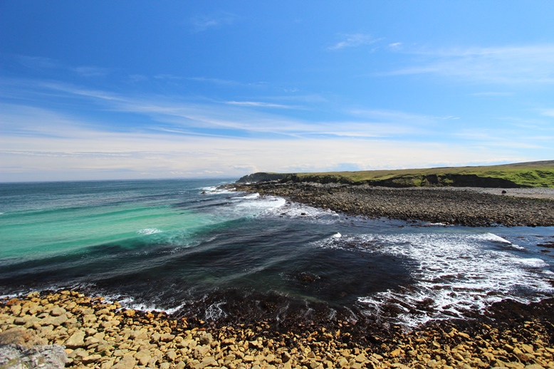
Dark coasts

Dark coasts

What would later be called Cape Wrath was only miles to the south, but there was no cape yet. Just the grinding of slow and unforgiving ice moving north into the North Atlantic. But the times were changing. The sun gained in strength, atmosphere and ocean started to warm and the gigantic ice mass, later to be known as the British-Irish Ice Sheet, was in decline. As its surface melted, more water reached its bed, and it began to slide helplessly over its own sediments. Slowly it thinned, and retreated in the direction of the Scottish mountains with the ocean lapping relentlessly at its edges.

There seemed to be no hope, but the ice sheet made one last bold dash towards the edge of the continental shelf before it faltered. The recently deglaciated seabed and freshly deposited grey ocean sediments were bulldozed and overrun again by ice on the move, and buried once more in a blanket of red till. Linear ridges (moraines) marked the limit of this temporary re-advance. But it was only a death throw; the re-advance didn’t get far. The ice sheet’s days were numbered. The advance stopped, and turned into irreversible retreat.

A geophysical search for the perfect core.......

A geophysical search for the perfect core…….

Against a backdrop of rumbling, calving icebergs, station JC123-048VC slowly became ice free, as the snout of the ice sheet moved back over the site. A cold, shallow sea took its place; first, still close to the snout of the ice sheet, where streams of meltwater rushing into the waiting sea water lay down a blanket of coarse sand. As the ice retreated further, taking the meltwater streams with it, the sea fell silent. Only fine sediments spat out into suspension by the dying ice sheet made it to our site, slowly covering it in a thick, grey blanket.

This slideshow requires JavaScript.

The ice sheet sent a final message as the ice margins retreated south towards the land; a message from an iceberg. As it passed, melting, overhead of station JC123-048VC, pebbles slipped from its icy grip. They plummeted into the depths, impacting into the soft fine clay sea bed. As soon as this excitement started it was over, and the pebbles were slowly covered by more of the same grey clay.

With the great weight of the ice gone, the Earth’s crust rose like an ancient giant from its slumbers, pushing the Scottish continental shelf closer to the sea surface. Over time, the waters shallowed, and the seabed currents became stronger. The last vestiges of the glacial seafloor were scoured by contour currents, which deposited the spoils of an energetic coast on the eroded sediment below. Millennia later coarse sand and shell debris formed a layer of several inches thick. And then on Sunday the 12th July 2015 all changed.

This slideshow requires JavaScript.

There was an unfamiliar thud, and then the uncanny sensation of a vibrating tube burrowing into the sediment from above. It cut through the sand in a jiffy, passed the pebbles, and into the soft clays. The tube slid through it like a hot knife through butter. No struggle with the coarse sands lain down by meltwater streams either, only slowing on reaching the stiff, red till. It battled its way into it for a meter and a half. Then the friction became too much. The vibrocorer stopped, and then the whole tube, now full of sediment, was pulled back up to the sea surface, and hoisted back up onto the deck of the RRS James Cook, the ship it had come from. Peace returned once again on to the sea floor, at core site VC123-048VC, a few miles north of Cape Wrath, on the northwestern edge of Scotland; a land mass now devoid of ice sheets and glaciers.

The core came on board and was cut into sections, labelled, scanned, and split. Finally, we, the scientists who had planned the project, planned the cruise, sailed all the way from Southampton to Cape Wrath, and waited for the British Geological Survey (BGS) to deliver the core, first laid eyes on the sediment. The story was there: a stiff basal till deposited beneath the ice sheet; fines marking the first incursion of the sea; further glacial till documenting the ice re-advance, meltwater stream sediments deposited in front of the retreating ice margin; the fine clays deposited when the ice began to recede southwards containing drop-stones from the icebergs, and the marine sand of the modern seafloor. That was what we had come for. And this was the 48th core; none of the previous 47 had told the story of the vanishing British ice quite this clearly.

This slideshow requires JavaScript.

Hopefully we’ll be getting more cores like this in the coming three weeks of the cruise. We need this story told in every sector of the British-Irish continental shelf. Only then will we have what we set out for: the complete saga of the Last British-Irish Ice Sheet.

Cruise 1: Days 1-6 trials, tribulations and triumphs

By Rich Chiverrell and co from the edge of the shelf

Developed as a concept 3-4 years ago, and planned over the last 2 years with massive input from across the Britice-Chrono team and Colm Ó Cofaigh (Marine Theme Leader), on Monday 14th July it finally began to happen, Cruise 1 (JC106) of the NERC Consortium Project Britice-Chrono. The vessel, the RRS James Cook was waiting for us moored at the wharfside of the National Oceanography Centre (NOC) in Southampton as the various team members mobilised. For me this would be a first, after running the terrestrial field programme for the past 18 months, and now for something completely different – having visited numerous boulders, quarries and cliff sections, the chance to see and sample the extensive offshore sediment and landform record of the decline/collapse for the former British-Irish Ice Sheet (BIIS).

The leaving of Southampton

The leaving of Southampton

Individual preparations for an undertaking like this began months ago; spending 3-6 weeks living offshore on a state-of-the-art research vessel does not happen overnight. In June marine survey or personal survival training qualifications were needed. This involved 7/8 hours of training and tests at the Fleetwood Nautical Campus, which covered survival equipment, how to abandon ship from a 5m platform and in the appropriate survival gear (immersion suites, life jackets, entering life-rafts, management of life rafts, individual and group mobility in the water). All this in a state-of-the-art 8-9m deep wave simulator, where for the finale we abandoned ship from 5m, in the dark, smoke everywhere, rainfall and spray, into a wave churning pool, after 5-10 mins in the life-raft mal-de-mer was looming! Medical certification testifying fitness to work was also needed. And then on to other tasks, helping with permissions for geophysical survey and coring in Irish, English, Welsh, Manx and Scottish waters all were required; remarkably all interpret EU law differently and this resulted in a major undertaking for Colm Ó Cofaigh amongst many others.

It was with a little trepidation and expectation that I first visited the RRS James Cook on Monday to drop of personal luggage and cameras (on board duties for me included amateur film maker and outreach obsessive). First impressions, a big and well equipped ship, and my cabin is more spacious than I expected. Second impression there was still a great deal to do before our scheduled departure noon Tuesday 15th July, with an impressive set of additional equipment being loaded as I arrived; the British Geological Survey waited on replacement cranes to load the 6m vibro-corer. The NOC 12m length piston corer was also working its way on board. A freight container that housed the University of Leicester Multi-Sensor Core Logger was also being loaded. The science team added research consumables to allow the sampling of ~200 core profiles and then on Tuesday ourselves for familiarisation and preparations to depart. It perhaps was more of a surprise than it should have been when our eventually departure lunchtime on Friday came around, because mobilising this scale of operation is challenging, and we did have a few issues with the vibrocorer that the BGS team worked largely round the clock to fix including extra and replacement equipment from Edinburgh. The wider BGS team got to know the route from Southampton – Edinburgh well…..

After some final repairs and tests of the vibrocorer and we met our Friday departure time, and headed for a date with the English Channel and a test location identified to the south of the Isle of Wight. Casting off and the journey to the Solent was in calm seas and glorious sunshine, within 3-4 hours we reached the test area, and the BGS and JC106 Science teams readied themselves for the fray. Using the RRS James Cook’s dynamic positioning system the crew manoeuvred the ship into position in 30-40m of water. The BGS team, thoroughly checking the physical operation of the equipment, lowered, sampled and recovered a vibrocore. The equipment was functioning fine, we were ready for the Celtic Sea and the Science team had materials on which to practice our procedures e.g. core cutting, splitting and description.

This slideshow requires JavaScript.

On finishing the test core location, the geophysical equipment was powered up, so that the watch teams could gain experience and practice the 24 hr geophysics monitoring duties. My first watch was 12 midnight through to 4am! Actually pretty good fun, not sure how quickly my body clock will adjust to a warmed up dinner for breakfast, breakfast for lunch and lunch for dinner, and for that matter sleeping 4pm til 11pm……

Saturday through to Sunday was spent in transit; the shelf edge of the Celtic Sea is quite a long way ~ 36 hours at ~10 knots. In the mid-morning our safety skills were put through the paces, with a muster drill, the alarms sound we secure warm clothing and life jackets and convene in the muster point, from which we are led to and board the two life boats. Very spacious, well kind of, the each can take ~50 people and we are a crew of around 50. You can imagine they would get very warm and pretty unpleasant if full of people for a long time.

On waking 11pm after not much sleep, still adjusting to the new life cycle… Taking over from the end of my day watch partner, Catriona, my watch was good fun acquiring the data for the next 5-6 hours involving scouting for core sites as we began our target geophysics transect on the shelf edge, with some success finding some promising targets in between problems with the Sub-Bottom Profiler. Riccardo and then Kasper followed, with ever present input from night coring lead Sara, night geophysics lead Fabio and Margot. On this watch we completed an acoustic velocity profile as a calibration for the multibeam survey systems, and worked the geophysics transect. Once complete we arrived at the destination for our shelf edge piston core. The piston coring team from NOC made quick work of the 459 meter, recovering ~ 4m (JC106-002PC). Fabio and the RRS James Cook computation team carried out a further calibration of the multibeam survey using the sea floor topography. The core awaits acclimatising to the MSCL container and whole core analysis of the physical properties with Elke.

This slideshow requires JavaScript.


At noon, the baton passed to day watch (Katrien, Lou, James, Catriona, Daniel, Zoe) and the challenges of obtaining five vibrocores along the geophysics transect in search of that Holy Grail, a contact between subglacial diamicts and glaciomarine deposits in 280m of water. JC106-003VC, the first stop, was on the flank of the western side of Little Sole Bank near an earlier BGS vibrocore. The materials were very tough penetrating ~1.6m, with a much consolidated stony diamict at the base; admittedly a little/lot early to say it looks a lot like what we were hoping for, and there are four more sites to follow, but….

This slideshow requires JavaScript.

Minching about on a sunny Isle of Lewis

By Rich Chiverrell

Port Skigersta delta

Port Skigersta delta

One of the smaller ice-masses draining the former British-Irish Ice Sheet, the Minch palaeo ice stream drained much of the NW sector of the British–Irish ice sheet (∼15,000 km2) feeding sediments to the large Sula Sgeir fan fronting the continental shelf. But if this is small, standing on the east coast of Lewis (Outer Hebrides) looking across the sunlit, blue seas and skies east to the feeder fjords and mountains of the Summer Isles and Wester Ross helps one visualise how large this former ice sheet really was. Our aim for this ongoing Briticechrono Transect 8 fieldwork was to secure a series of targets for Optically Stimulated Luminescence (OSL) dating from outwash sands from Lewis, one of the outermost land-masses on the western flank of the Minch Ice Stream. This work will support previous sampling efforts targeting boulders on the Scottish Mainland and the Hebrides for cosmogenic nuclide dating. Previous OSL sampling had targeted the inner sector of the Minch on Skye and north of Ullapool. The team (Rich Chiverrell, Matt Burke, OSL Postdocs Rachel Smedley and Alicia Medialdea) set off first thing on Tuesday morning to join Transect Leader (Tom Bradwell) on Lewis. Departing a cloudy Manchester via Glasgow Airport we landed before lunchtime to blue skies, sunshine and searing temperatures at Stornoway Airport.

This slideshow requires JavaScript.

Inspired by our surroundings, the weather and the prospect of excellent sediments the four newcomers sped off to meet up with advance team Tom Bradwell, Adrian Hall and Maarten Krabbendam (from the Netherlands) at Port Skigersta in the far north of Lewis. The site an embayment on the western flank of the Minch Ice Stream gave stunning views across the water back to the ice source areas in western Scotland and beautiful turquoise seas. The sediments were very impressive with the sequence a stacked delta sequence with steeply dipping fore-set sands capped by top-set horizontally stratified gravel. Intriguingly the basal delta is buried by laminated bottom-set muds, in turn buried by a second delta fore-set and top-set couplet. The repeating delta suggests changes in water level probably lake level, dammed between the ice stream and bedrock rise into Lewis. We sampled both deltas close to the fore-set – top-set contact. And then for some geological tourism, the raised beach at Galsom guided by Adrian Hall, stunning and confusing sediments, all contributing to produce a plethora of hypotheses. Difficult to address under the banner of Briticechrono, the beach deposits (guess the isotope stage) appear altered by over-ride by ice, locally there is a surface diamicton and the beach pea/rounded gravels are probably thrust or stacked. We have targeted an outwash (ish!) deposit above a glacial diamicton, fingers-crossed for contributing to the debate. Excellent food followed at the Cabarfeidh Hotel our home for the next few days (well some of us!).

This slideshow requires JavaScript.

Day 2, still warm, still still (no winds) and the sunshine popped in later! After an epic breakfast (Lewis did us proud) back to the north and just south of the Butt of Lewis the west coast Swainbost Sands offered much promise. The sections were epic more glaciotectonics, tills, shells than you can shake a stick at, and the beach!!!! One of the best beaches I have seen in the British – Irish Isles…. Selecting targets was challenging, much of the outwash deposit was rich with shells, thrust, tectonised and not where it was deposited! How? Well by marginal movements and override by ice and at a substantial scale. Three sample locations were found and in the back, along with crucial in gamma detector comparisons, duplication with different detectors at some of the samples. The sampling completed our targets after ~36 hours on the islands, and so we racked our brains for other targets. After a quick visit ~5/6km south down the west coast of Lewis where we encountered convincing striae in steeply foliated Lewisian gneiss, where the glacial lineation trends cross obliquely the metamorphic structure heading northwest. We also prospected for sites further up-ice around Stornoway; another fine meal at the hotel and some gin-assisted colour-by-numbers approaches to former ice geometry and let’s see what tomorrow brings for our last 3-4 hours on this eye-opening island (hopefully a final sample)….

Rapid retreat of the Irish Sea Ice Stream – just out in the Journal of Quaternary Science

Irish Sea Ice Stream

A new paper has just been published by Richard Chiverrell and a hefty team of Britice-Chrono co-workers (James Scourse, Katrien van Landeghem, Chris Clark, Colm O Cofaigh, Dave Evans, Danny Mccarroll, Colin Ballantyne) presenting the first Bayesian integration and modelling of all the dating control for the marine sectors of the largest ice stream that the last British-Irish Ice Sheet ~ 24,000 years ago. The modelling shows very rapid retreat for this marine-terminating ice stream over greater distances (650 km) and timescales (8000 years) than is available from short term (decadal) observations of present day ice stream margins. The modelling shows this retreat 24,000 years ago was rapid and linked with climatic warming, sea-level rise, mega-tidal amplitudes and reactivation of meridional circulation in the North Atlantic. But, significantly the pattern of retreat appears uneven with a pulsed pattern of retreat attributed to the passage of the ice stream between normal (sloping away from the ice margin) and adverse (sloping towards) ice bed gradients and changes in the geometry or marginal constriction of the ice stream. To read more click here.

The methodology and application kind of formed an important test case for Britice-Chrono as we attempt to constrain rates of and controls on marine ice stream retreat over millennial timescales for eight ice stream radiating out from the last British-Irish Ice Sheet. The methodology outlined in the paper will underpin and be used as a guide for our data collection for the wider British-Irish Ice Sheet. It would be quite good fun to play around with some of the available chronology for other ice streams…..

For news and updates on Britice-Chrono see our Twitter site and everyone please get tweeting or twittering!.